Last day for this stay by the Dragoon Mountains. It was warm with almost no breeze, a perfect day.
Spent the morning just doing little chores for the VRRV, burning trash, and fixing loose items on Yagi, my TW200 Dual Sport.
After lunch, I took Yagi out for a run out to Council Rocks and back, about 12 miles or so. I wanted to prove to myself that yesterday's outstanding traction performance by Yagi hadn't been a fluke you see.
I'm happy to report it wasn't, she was surefooted all the way to Council Rocks and back. I made it a point to seek out the rough portions of the road, the more loose rocks the better! After a while, I even took to riding in the middle of the road where the sand and gravel had collected. It was very enjoyable, not worrying about the tires sliding out perhaps when hitting the loose stuff.
The only time I felt the rear tire slide a bit was on really deep sand and I recovered easily due to the better traction provided by the lower air pressure in the tires!
On the rocky hill portion, I chose the middle again, right over the bits where the loose rocks were the thickest and no problem! It was quite lovely, I must say.
I rode by Dave and Gus' campsite, they had returned from running errands in town. We chatted for a bit and then said my thanks and goodbyes to both as I'm planning on displacing tomorrow.
Nine days here at the base of the Dragoon Mountains, west side, and an enjoyable time it was. Met an experienced rider who taught me ways to enjoy dirt riding more, what more can one ask?
After a rather relaxed morning of just sitting and reading under a warm sun, basking in the warmth in spite of the shade provided by trees, it was time for some riding.
Actually, the plan had been initially to just go on a pootle, not really exceeding 20 mph and therefore I skipped fully gearing up. Yes, I know, bad. Very bad.
I was joined by a fellow camper, Dave and his dog Gus. Dave hadn't been expecting to do serious riding and so wasn't wearing gear either.
The two of us rode out to the FR345 road and headed towards FR 697 which took us up the side of a hill. Dave, during one of our stops remarked that my TW200's tires appeared to have too much air.
Too much air means not enough flex or contact surface explained. As I sat on the TW and rocked the front forks while holding the front brakes, he let some air out of the front tire until I was getting a better contact footprint. He did the same to the rear tire as I bounced up and down on the seat.
I must say, the resulting change in traction and performance by the TW was remarkable! She wasn't as bouncy on the rocks anymore and felt more surefooted! I had always though airing down was for deep sand....how wrong I was.
Yagi's performance was so confidence inspiring that not only did I not turn around at a rough patch of rocks but we continued onwards and upwards! Mind you, we were going pretty slow since Dave's dog Gus was setting the pace!
photo courtesy of Dave
Here's "The Gate" just before China Camp, a set of concrete slabs that are all that remains of a camp. Apparently, this road had been built by Chinese laborers to provide access to mines in the area. China camp was where they lived while doing this work.
photo courtesy of Dave
photo courtesy of Dave
photo courtesy of Dave
photo courtesy of Dave
We kept going up and up, the trail getting rockier and rockier. I did drop the TW once, in a very deep rut where I hesitated and stalled it. No harm, no foul, but it was a good reminder that I should have been wearing gear!
We got almost to the top of the road but it got too steep and rocky for me. So Dave and Gus continued onwards and got to the top, and got this photo:
After Dave and Gus came back down, we made our way down the mountain, me learning to not use the rear brake and to gently use one finger on the front brake to slow down when needed. It helped a lot on the really rough and rocky parts I must admit.
Dave noticed that Gus was having some issues with running on the way down and decided to get him to ride on the front. Gus at first didn't like it one bit and kept trying to, and succeeding, in jumping off after Dave would ride a little ways.
Once we got back on FR345 which was smoother and more level, Dave tried again and this time Gus seemed to get the idea of staying on the bike:
We then made better speed all the way back to our campsite. I must say again, the lowering of the air pressure on the TW's tires made a rather significant difference in traction. The loose gravel and rocks were like nothing to me now. I shake my head on how much I've been basically fighting Yagi, the TW200, by not lowering the air pressure when off road! Oh well, now I know and must practice more in this manner.
My thanks to Dave for showing me this setup and the riding tips he imparted while we rode along.
It was, per Google Maps, 7.3 miles from campsite to the furthest point reached by me.
I measured the air pressure the next morning: 6.5 PSI cold.
All these years, I thought Huachuca, the name of the Army Post located in Sierra Vista, AZ and home of the Army's Military Intelligence Branch meant Dirty Water.
Dirty Water you ask? Huachuca, sounded a lot to me as: Agua Chuca which is Spanish for Dirty Water you see.
Well, today I learned otherwise. It's actually from a Native American word for Mountain Thunder. So now you know as well.
Anyways, though sunny, it would prove to be a windy day which made things feel rather cool in terms of temperature. That and all the day trippers and weekenders by the Dragoon Mountains where I'm boondocking dictated my driving to Fort Huachuca to check out its museums.
First up was the Fort Huachuca Museum which depicted Army Life back in the early days of the mid to late 1860s to after WWI. There's a heavy emphasis on the Buffalo Soldiers or Black troops who were stationed there before the US Army de-segregated in the 1950s.
Here's some of the exhibits which caught my eye in the small but well put together museum:
The soldier second from the right, wears the blue helmet issued to him by the French Army during WWI. The 93rd Infantry Division would fight along the French army and were issued (to facilitate logistics) with French weapons and gear you see. The helmets for them were a distinctive blue, which became an iconic symbol and part of their history. More info on the Buffalo Soldiers in WWI here: LINK
Here's two Buffalo Soldiers depicted in the uniform worn while in the 10th Cavalry and during the campaign to capture Pancho Villa.
The museum also displayed items related to the battles fought by the US Army and the Apache tribes in the region. The below photo struck a chord with me as I'd recently heard a podcast by SYSK, Stuff You Should Know, where they'd detailed some of the history and misinformation about this 25+ year long war fought by the US Army.
Cochise and Geronimo are two of the Apache leaders who featured prominently. I recommend you listen to the SYSK podcast if you can, I found it very informative. Link to podcast
Geronimo
I didn't know before, the history behind what is presently the branch insignia for US Army Special Forces officers. The modern day version is very close to the middle insignia below.
A status in honor of the Indian Scouts employed by the US Army. It's positioned in front of the old Post Theater which is now the museum annex.
One of the exhibits within the annex was the Slugger. That's what we called it when we were introducted to them during Operation Desert Shield (oh so long ago). Their designation was SLGR you see, which stood for Small Light GPS Receiver.
This was the device which enabled army formations/units to cross vast tracts of desert in Saudi Arabia and later Iraq and not get lost.
The main emphasis of the museum annex though, was a display of Army UAVs. It was OK but nothing of any real interest by yours truly. The only UAV that caught my eye was this one:
Outside the museum annex, there's a "walking tour" which information placards at intervals detailing some history of a particular location. I only checked out two of them however.
In case you were wondering why the US Army back then chose this particular spot in Arizona to create a post:
A short drive from the Fort Huachuca Museum, is the Military Intelligence Museum and Library. Nicely done but again, only a few things caught my eye.
This chunk from the Berlin Wall was quite colorful I thought. The sign reminded me of my visit to Checkpoint Charlie in Berlin, back when there were two Germanies.
So, besides it's slight resemblance to the Sammy, why did this catch my eye? Because of the role it played with the US Military Liaison Mission. I'd never heard of this unit/program. Very interesting, far as I gather so far, the were "authorized" spies from each side of the Cold War, wandering in the others' territory.
Anyways, that's it for the museums, I gassed up the Sammy and left to return to the campsite shortly before 12:30 PM I believe. An hour later I was back at camp and it was quite breezy still, so the rest of the afternoon was spent relaxing inside the VRRV.
It's supposed to be warmer tomorrow, I hope that means no cool breezes making it seem cold. I sure have lost any resistance I might have ever had to cold weather I tell you! Could be the blood pressure meds I've been put on for the last few years I suppose. Oh well.
While relaxing in the VRRV, I found this Youtube video which I thought was a good account of the Dragoon Mountain area. There is a plethora of videos about this area it turns out, not much of a secret.
Ah, the sun is back along with mostly clear skies for the majority of the day!
Today I decided to explore the trail that leads towards the Skyline Traverse Trail on the NE corner of the Dragoon Mountains.
You basically follow Road 687, past the fences and gates put up by Dragoon Mountain Ranch (gated community), and then wind your way around in a south-easterly direction. Its very rocky terrain and I was feeling pretty proud of the Sammy's handling of it but then started seeing cars and light trucks camping alongside the road.
These were cars and vans with normal clearances, doubt many of them even had 4WD! Yet they somehow managed to make it to the campsites in question!
Not even three miles from the property line of the Dragoon Mountain Ranch, I came to a small turnaround point. There were cars/vans/trucks all around it in the trees. Not sure how some of the cars got there but they made it.
I turned around and retraced my route back:
I spotted a side road and took it to gain a different angle on some rock formations:
Back on the road towards Rd 687:
Once I was close to camp, I ran across these two gentlemen and this spiffy looking '73 Toyota Land Cruiser. She's got twice the horsepower over the Sammy I was told, but the driver said he prefers to stay at 55 mph when on the highway. Apparently she can manage 60-65 mph but the steering gets a little squirrely.
Nice rig eh?
Have you ever noticed, how the top of the Sammy's seats looks like a burka wearing woman, in a bad mood? ;)
I returned to camp, rested in the late afternoon sun for a bit, then caught the sunset before dinner preparations:
The area is getting pretty full as of today. Lots of campers, tents and speeding ATVs making one wary of turning a corner on the road. Had one close call with one of these idiots, but the fool managed to brake hard and swerve to avoid hitting me.
Yep, it's the weekenders.
I think I'll avoid them all tomorrow and head into Sierra Vista and Fort Huachuca to check out the museums there.
Didn't accomplish much in terms of scenery. A drive up Road 687 that Google Maps said was a back way to Texas Canyon proved a blocked route. The Dragoon Mountain Ranch had barred public access, something not taken into account by Google.
Back at the campsite I noted that the recent resumption of coolant fluid by the Sammy was worsening.
Decided to take the Sammy to Benson, AZ on Interstate 10 and get more K-Seal cooling system sealant. Sealant procured and some poured into the coolant reservoir; I figured to drive east on Interstate 10 the estimated 10 miles to Texas Canyon.
Bad idea, the Sammy was continually passed by speeding traffic, and she felt like she was struggling to hold 55 mph!
Still, got to the exit at Mile Marker 318 and determined no ready access to Texas Canyon! It's all private land and the only public access of the rock formations are either from the highway while moving or from the nearby rest stop. Oh well
Ran the Sammy back on the Interstate, no other road you see, and was glad to make it back to Benson and AZ Highway 80 for the 30 mile or so ride back to camp!
On the plus side, the coolant reservoir stayed filled up so hopefully the K-Seal will once again buy me some time before I either decide to tackle a head gasket replacement on my own (unlikely) or take it to the auto shop to have it done
Here's a couple of pics I forgot to publish from Tuesday's ride to Council Rocks. These were taken using the Sony HX-80's great optical zoom feature:
Who needs Texas Canyon's rocks, right? Thursday, November 24 - Thanksgiving Day
Cold, overcast day for Thanksgiving Day here. The high was forecasted to be 52 degrees Fahrenheit, but thankfully it rose to 57 degrees when the sun briefly shone through the clouds.
The sun being out, the temperatures felt warmer than they actually were. Still, it was nice to sit in the sun and read for a little while anyways.
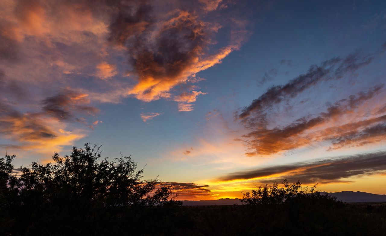
Tonight's sunset was pretty good. Hope everyone had a good Thanksgiving Day, those of who celebrate it that is.
Today was forecasted to be the warmest day this week and it only reached 68 degrees Fahrenheit! Still, it was somewhat sunny with lots of clouds overhead.
First order of business was a drive to nearby city of Sierra Vista to get some supplies and such. Got gas in Tombstone before returning to the campground and putting away the supplies.
Then, after not much of a lunch, I rode Yagi out to Council Rocks since the sun was shining for a while.
I'd been there before but this time I concentrated efforts on the petroglyphs located on one of the larger rocks comprising the sheltered area used by Native Americans in times past.
From that previous post, here's the main portion of Council Rocks, where the petroglyphs are located:
Here's some of the cool rock formations visible just a very short distance from the above spot:
Today's pics of the petroglyphs:
I got to say, the above figures are kind of freaky
I wonder what the difference or significance of the vertical
vs the horizontal convoluted lines are....
The above figure was located up high, like it was looking down
I left Council Rocks and rode Yagi along the west side of the Dragoon Mountains, stopping to pose her where appropriate.
Council Rocks is that pile of rocks on the extreme left of the picture
Got back to the campsite close to 4 PM, it was cooling off pretty fast by then with the clouds pretty much obscuring the sky. Sunset was a very bright orange glow for a bit....kind of neat.