Saturday, May 29, 2021

Riding to Marshall Pass with Bob W.

Back in October of 2020, I was taking Fall Color pictures along the road that takes one to the summit of Marshall Pass.  There's Aspen trees a-plenty along the road and up the hill and mountain sides.  For a taste of last year's Fall Colors, click this LINK.

Today, Bob W. and I rode our Yamaha dual sports to the Silver Creek Lakes Road via the Bonanza OHV Loop located conveniently near the campsite.  The way up and down was a bit technical at times but neither of us had major issues; that is except for the young morons on their dirt bikes racing past us in a rush to meet a stony impact/death.  Oh well.

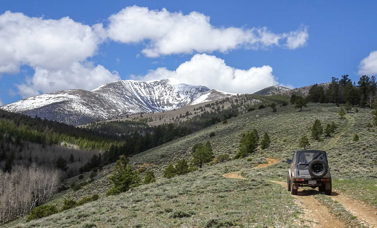
We made it down to the Silver Creek area with no issues, made our way past campers and campsites, and finally got onto Marshall Pass Road.  We stopped briefly to look over O'Haver Lake and then decided to try for Marshall Pass even though I'd seen a sign last week saying it was closed through end of May.

Good thing we tried, the gate was open!  We continued on and after a few more miles were at the summit under cloudy skies.

We continued onwards past the summit into the Gunnison National Forest for less than three miles before turning around due to increasing lack of scenery and potential thereof.  Just miles and miles of thickly forested hills and steep drop offs to valleys below.

After checking out the summit area (there's tent camping there) and also additional camping a little further down with its own pit toilets, we retraced our route and stopped for a bit at a big set of rocks to hopefully get a picture of the marmot we'd seen on the way up.

Alas, he was much too wary of us and all the weekend OHV and car traffic on the road, this is all I managed to get:

Continuing on, we once again went past the overlook for O'Haver lake and soon after took the turnoff for FR 204.  After one bad turn, finally found the right 204d trail that dead ends on private property.  I wanted Bob W. to see the house on the lake that I was sure his wife wanted him to buy for her!  :)


Making our way back to the main FR 204 trail, we stopped for a picture of Mount Ouray:


As it threatened rain by now, we now made our way back to US Highway 285 and from there quickly ran up to the summit of Poncha Pass and soon were back on BLM land and our campsite.

The rest of the afternoon was a bit cool and windy with very very very brief periods of sunshine peeking through the heavy cloud cover.  I hung out at the campsite and Bob took his truck into town for some groceries.

A good day of riding to be sure.  I expect the plethora of camper rigs dotting the surround area will start leaving tomorrow, hopefully, though most likely they'll wait till Monday as this is the Memorial Day Long Weekend.

Friday, May 28, 2021

Riding Yamaha motorcycles in the Poncha Pass BLM area with Bob W.

 A pretty good morning in terms of warm sunshine and few clouds, this would change later in the day to more cloudy conditions and some wind.  Still, not bad at all for riding.

Bob W. had brought along his 2020 Yamaha WR250R dual sport and I was riding Yagi, my TW200 dualsport.  I led Bob to the southern end of the BLM area and we rode up a couple of narrow trails which presented "interesting" conditions at times, probably leading Bob to wonder about my sanity.

Still, we made it up and back (from the point where we decided to turn around due to increasingly steep and rocky conditions) with no crashes or injuries.  After an abortive ride within the San Isabel National Forest, we tried the trail that followed Clover Creek, climbing higher and higher but finally stopped by rushing water and a look at snowy conditions up ahead.


A couple of ATVs came up behind us as we dithered in the pics above, and they'd done the further on portions before.  They're judgement as to the mud and snowy conditions led us to easily decide to turn back.

Returning back towards the main camping area, I led Bob through the remaining trails and finally stopping briefly with Mount Ouray in the background for a pic:


We returned to camp and had lunch, then around 2PM we headed out once more under increasingly overcast skies towards US Highway 285 and to the exit for Dorsey Creek Road.

First, a stop at picture point, the hill top which shows both Mt Ouray, part of the Collegiate Peaks to the north and the Sangre the Cristos in a line heading south:


Next we went up to the top of the trail and found the remainder of the "road" closed seasonally for "preservation of resources".  Heading back down a bit, we found and turned onto Dorsey Creek Road and rode it to the end.  Some steep parts, some deeply rutted parts, a lot of loose rocks, made for a challenging ride at times, but again, no crashes by either of us.  Close, but no cigar!

After wandering about for a bit on a different trail which basically was a big look of open forest land surrounded by private properties; we returned back to the west side BLM area via the entrance to FR 5325.  We rode the back ways back to the campsite, stopping only for cattle gates and to show you how the Aspen are greening up finally:


A good first day of riding with Bob.  Tomorrow, I hope to lead him through the back way to the O'Haver Lake area, bypassing the tortuous ride up Poncha Pass and down to O'Haver Lake Road exit.  We'll see how that goes.


Thursday, May 27, 2021

Slow overcast day followed by sunny day and Bob W.'s arrival.

 Wednesday, May 26

It was overcast most of the day, so no riding done.  Did drive into town to pick up the VRRV's medicine cabinet.  I had the broken mirror replaced by a local glass shop.  Picked up gas and some groceries and returned to camp.

Bob W., a neighborhood friend will now be the only one joining me at the campsite, tomorrow.  Jim M. had some scheduling conflicts and personal matters to attend to and dropped out of the trip today.

Sunset was OK:


Thursday, May 27

Sunny and warm day today, a bit brisk in the morning but by 10 AM it was nice and warm and just got better as the day wore on.

The local fauna paid me a visit at the campsite:


I went for a drive in the Sammy since Bob wasn't due in till no earlier than 4PM, explored some forest roads I'd not ridden before, added a couple to the list to be explored on two wheels with Bob starting tomorrow.

The area is definitely starting to fill up in terms of camping rigs and OHV (Off Highway Vehicles) traffic!  There's at least ten, probably more, campers strewn about the area, though fortunately none are real close to my campsite.  


Bob W. got to the campsite sometime close to 5 PM I think, having made a couple of stops in town for supplies and gas.  He got set up pretty quickly and soon we were chatting by the camp fire.


More fauna came by the campsite to visit for a bit, then were run off by OHVs driving by on the trail.


As we chatted, we watched the setting sun color the clouds over the Sangre de Cristo Mountain Range.  I wonder if something similar to the below was what caused the early Spaniards to name the mountain range as they did?

What a perfect day today was, and it's supposed to be the same weather tomorrow!

Tuesday, May 25, 2021

Sunnier weather is here, a recce of future riding spots

 Didn't do much driving/riding on Monday, it was still a bit cool though the sun was out more often than not.  I spent most of it puttering around and replacing the torn rubber cover on the Evil Twin Sticks shifter setup on the Samurai.

Took photos of the sticks themselves where they enter the cylinder which mates to the top of the Samurai's transfer case.  That's how I determined they're the Evil Twin model, not the Gemini Twin model for which a dust cover exists.  In the case of the Evil Twin Sticks, one has to use a rubber glove to craft a cover to keep water and dust out of the transfer case!  

The spot on the transfer case is where overage of gear oil also comes out!  That's how I discovered the rubber material covering said mating point on Monday, big spot of gear oil on the ground!  I think, water got in while splashing in the puddles and it burped out afterwards.


Anyways, drained the contaminated fluid out (it looked like OD Green paint) and put fresh fluid in.

Tuesday, May 25

The sunny weather continues, with a few more clouds throughout the day but not too many.  It felt warm when the sun shone through!  I drove the Samurai out to US Highway 285 and turned south for perhaps a mile to get to the exit to more forest trails on the east side of the highway.


I wandered about familiar roads (I'd ridden these before on a previous stay in the area), making sure they were available for riding probably on Thursday/Friday this week.  I'm being joined by two neighborhood friends: Bob W. and Jim M. and they're bringing their dual sport motorcycles!

Here's some of the scenery from the east side of the highway and along some of the forest roads I drove in the Samurai today:

The Sangre de Cristo Range

Mount Ouray

Note to self, try and not shoot into the sun....post-processing is required and it never looks quite right:

Another shot of Mount Ouray from higher up


Sunday, May 23, 2021

Cold and Rainy Day activities and Yagi welcomes sunnier weather

 This weekend has taken a long time going by.....I know, I know, weekends never last long enough for most working folk, but I'm retired you see.  

Saturdays was a windy, windy, windy day....thrown in heavily overcast skies and occasional rain and it was basically a day spent in the VRRV!

So, how does one pass the time?   There's reading of books, cleaning, catching up on minor repair jobs involving the solar panels, reorganizing the storage within the VRRV and finally editing digital imagery!

Yep, the major event on Saturday was finding, and modifying a cutaway drawing of a Suzuki Samurai from the cover of a Haynes Car Manual for the same.  I also bought a used version of this manual for future reference.


Why you ask?  Perhaps, if I end up keeping the Samurai, I might have a poster sized version of this cutaway drawing for hanging in the garage.

During a very brief window, a rainbow showed itself during
Saturday afternoon.

The crappy weather continued overnight (with periods of heavy rain which woke me) and it would continue through Sunday morning.  Fortunately, the skies cleared sometime in the early afternoon and the sun was able to warm things up a bit, though there was still some windy conditions.

The winds had at times, caused me some worry about whether the nearby trees might fall onto the VRRV....so I displaced it a few feet towards the center of the campsite:


The improving weather made it a prime time to take poor Yagi, my Yamaha TW200 dual sport motorcycle, out for a spin!  Things were still cool enough at this altitude to require a liner under my riding jacket but it was a fun time.

Mount Ouray

Part of the Sangre de Cristo Mountain Range


A better view of the entire Sangre de Cristo Range


The Collegiate Peaks to the north

Riding Yagi was quite enjoyable and there were less than 4 other campers in the area as I cruised around to see what neighbors I had.  I expect the number will increase as the Memorial Day Weekend approaches.  The next few days are supposed to be mostly sunny and I for one am ready for them!


Friday, May 21, 2021

Salida, Colorado: Then and Now

 Another errand run into the town of Salida this morning, while there I decided to see how many "then and now" pics I could get in the Historic Downtown area.

Wikipedia: A post office has been in operation at Salida since 1881. The community was named on account of its location at the upper end of the canyon containing the Royal Gorge, Salida meaning "exit" in Spanish.

It's actually a nice little town, with fewer than 6000 inhabitants apparently.  I power washed the Sammy just to get rid of the copious amount of mud that had caked the underside during previous fun drives with Chris and Lori.  Got more oil for both the Sammy and a planned generator oil change, parts for the Sammy's door rod which I need to adjust for hopefully easier opening.  The theory from Chris is the aftermarket seats are pushing against the door panel, causing opening difficult you see.

Anyways, errands accomplished, I cruised the downtown area and where I found a reference photo from the Denver Public Library's online database, I took a "now" shot for your viewing pleasure.  You should be able to spot the Sammy in most of the shots.

The Manhattan Hotel circa 1994
Constructed 1901
image source: DPL: AUR-991

Palace Hotel circa 1994
constructed 1901
image source: DPL AUR-993

The Twitchell Building circa 1989
constructed in 1880
image source: DPL: AUR-995

Here's a closer view of the mural in the picture above:

Hopefully, when they go to remove the mask someone taped
onto the mural, they'll not damage the mural.


F Street View circa 1920-1929
image source DPL: x-13259

Here's the mural partially shown in the photo above:

As I crisscrossed my way through the downtown area, I happened upon this nice looking Samurai.  I kind of like the soft top it sported, don't you?

As you can see in the pics, it was nice and sunny in Salida.  It was T-Shirt weather really and folks were out enjoying the warm weather with no wind.

It was a different story almost 2200 feet higher where the campsite is located!  Heavily overcast and strong gusty winds with temperatures in the low 50s!  Still, the lack of people at this location makes up for the nice warmth down below by the Arkansas River!

Thursday, May 20, 2021

Lori & Chris leave, and driving around the O'Haver Lake area

Doing some picture catching up.

Here's a picture of  Tuesday evening,  it was time for some medicinal therapy inside their habitat module after dinner courtesy of Chris.


For the record, we'd reduced the level on the Gentleman Jack Monday evening!  The Tincup whiskey on the other hand was opened Tuesday evening, it was however, a smaller bottle.  Just saying.

Wednesday, after the previously reported muddy driving with the Sammy, around 3PM, the wet weather produced a grand finale: Hail!


As you can see, it was only pea-sized hail so no damage to the vehicles.  Afterwards, Chris & Lori came by the VRRV to say their goodbyes.  They're continuing the journey towards Oregon and Chris' camp hosting gig.


Safe Travels my friends!

The weather cleared up around 5PM or so, with the sun actually peeking out among the clearing clouds.


As the sun set however, the clouds moved in again, darkening the landscape.


Thursday, May 20

Sunny skies for the most part and a high of 65°F (18.3°C)!  The only downer was the wind, it was pretty gusty and robbed one of the warmth imparted by the sun.

I drove over to the O'Haver Lake area after an errand run into the nearby town of Salida, CO.  The Sammy and I explored familiar trails, sections of which were quite muddy I might add.  On FR 204, I took it to its end at a private property's fence line.  The view was pretty good:


Heading back towards O'Haver Lake

One of many Aspen Groves in the area

I drove towards Marshall Pass but would find a locked gate closing the road a bit further up from O'Haver Lake.  The road is closed for utility work (according to the sign) through May.

Turning around, I took pics on the way back towards O'Haver Lake:


O'Haver Lake


Returning to the BLM area south of Poncha Pass, it was time to pose the Sammy near the same spot as Wednesday's evening's overcast shot for comparison: