Thursday, March 31, 2022

Now in Utah, Boondocking by the Lady in the Tub

 I displaced to the Valley of the Gods, Utah this morning.  By 8:30 AM I had topped off the propane and gas tanks and was heading north on US191 out of Chinle, AZ.

About two hours later, I got to the west end of the Valley of the Gods road and shortly found my desired spot was taken.  Dang it.  I had to go another 2 miles or so east to find myself a spot by the rock formation known as The Lady in the Tub.


So, do you see a Lady in a Tub?

A bit later, before the clouds really moved in, I headed out on Scarlett to see what I could see.


Here's a closeup of the Lady in the Tub


I like the composition presented by these formations

The Castle Butte area is as far as I went, I decided
to save the other half of the valley for later on.


I did run by to check on the site that I'd originally wanted, it was occupied by tenters...so hopefully they won't stay long.  If I see the spot open, I'll do a hasty displacement.

Nearby, is a different angle on the Lady in the Tub:


I love this area.  I'm close to the Moki Dugway, Gooseneck State Park, Mexican Hat and an area yet to be explored by me: Muley Point.

Stand by for lots of rock formation pictures.

Wednesday, March 30, 2022

T'Dubing Canyon de Chelly's North and South Rim Drives

 A slightly warmer day today, though the best warmth didn't make itself felt till later afternoon, AFTER I was done riding!

Still, a pretty good day, even though I spent most of it wearing long underwear in spite of the mostly sunny weather.

First was the checking out of the overlooks on the North Rim of the canyon, there's only three official overlooks but they are quite large.


Mummy Cave Overlook's cliff dwellings:


Massacre Cave Overlook and its dwellings:


Mid-afternoon (I should have waited till after 4PM but the clouds were iffy looking.  I returned with Yagi to the South Rim to peruse the views at Spider Rock, Junction and Tsegi Overlooks:


pano


Navajo Fortress

Tunnel Canyon

Made it back to camp with no issues and packed up the motorcycles in readiness for an early move tomorrow towards Utah.  It was actually nice and warm for about an hour!

The previous post to this one shows more of the South Rim's views, in rainy conditions...

Tuesday, March 29, 2022

Now at Canyon de Chelly, Uraling the South Rim in the Rain/Hail

 Left before 7AM in a light rain.  Drove the 19 miles or so to Holbrook, AZ where I got gas for the VRRV and breakfast at McD's.

A short hop on eastbound I-40 and then it was state and Navajo reservation roads.  Some sections of the reservation roads were quite uneven at times, so I had to slow the VRRV down from 55 to 50 mph to prevent her from bouncing all over!

Luckily, traffic was light so the speeders got past me easily enough, and disappeared from sight as they went way above the speed limit.

Got to the the Cottonwood Campground run by the Park Service.  The Canyon de Chelly is a National Monument located within tribal lands so a different situation from the usual monument/park.  Still, there were plenty of spaces, level paved sites and not much else.  Still, it's only $14/night and no much in the way of choices otherwise.

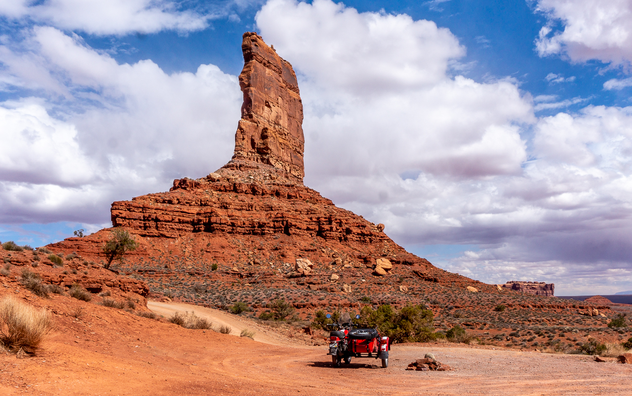
By 2PM I was all set up, and though it was still spitting rain and the occasional small bit of hail; I geared up and rode Scarlett to check out the South Rim Drive for the canyon.
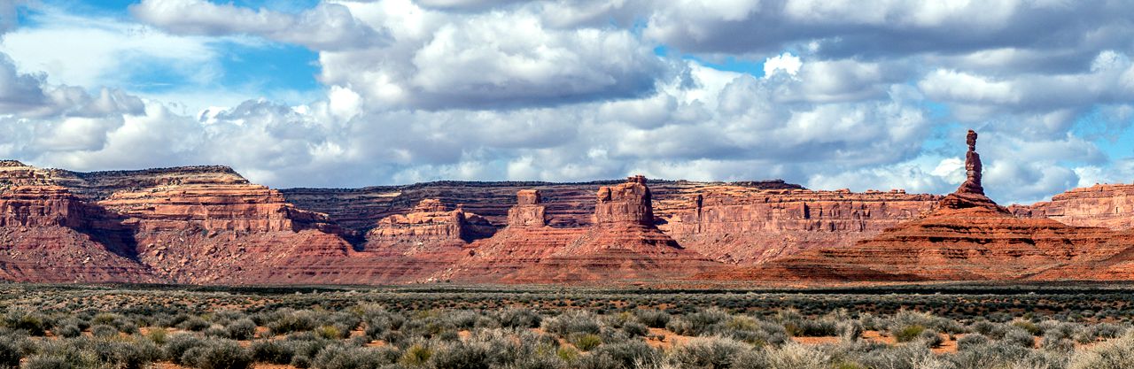
Tsegi Overlook Pano

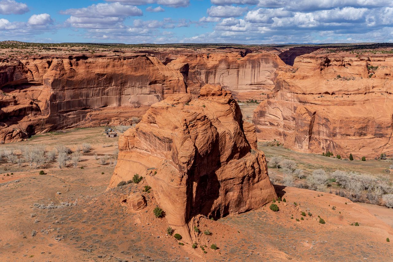
Junction Overlook view

Since the canyon is on Tribal Lands, the farms you see at the bottom of the canyon belong to tribe members.  What a view they must have.


Closer looks at Junction Overlook:


The view from Junction Overlook

The leftmost(shortest) rock formation is apparently known
as the Sliding House

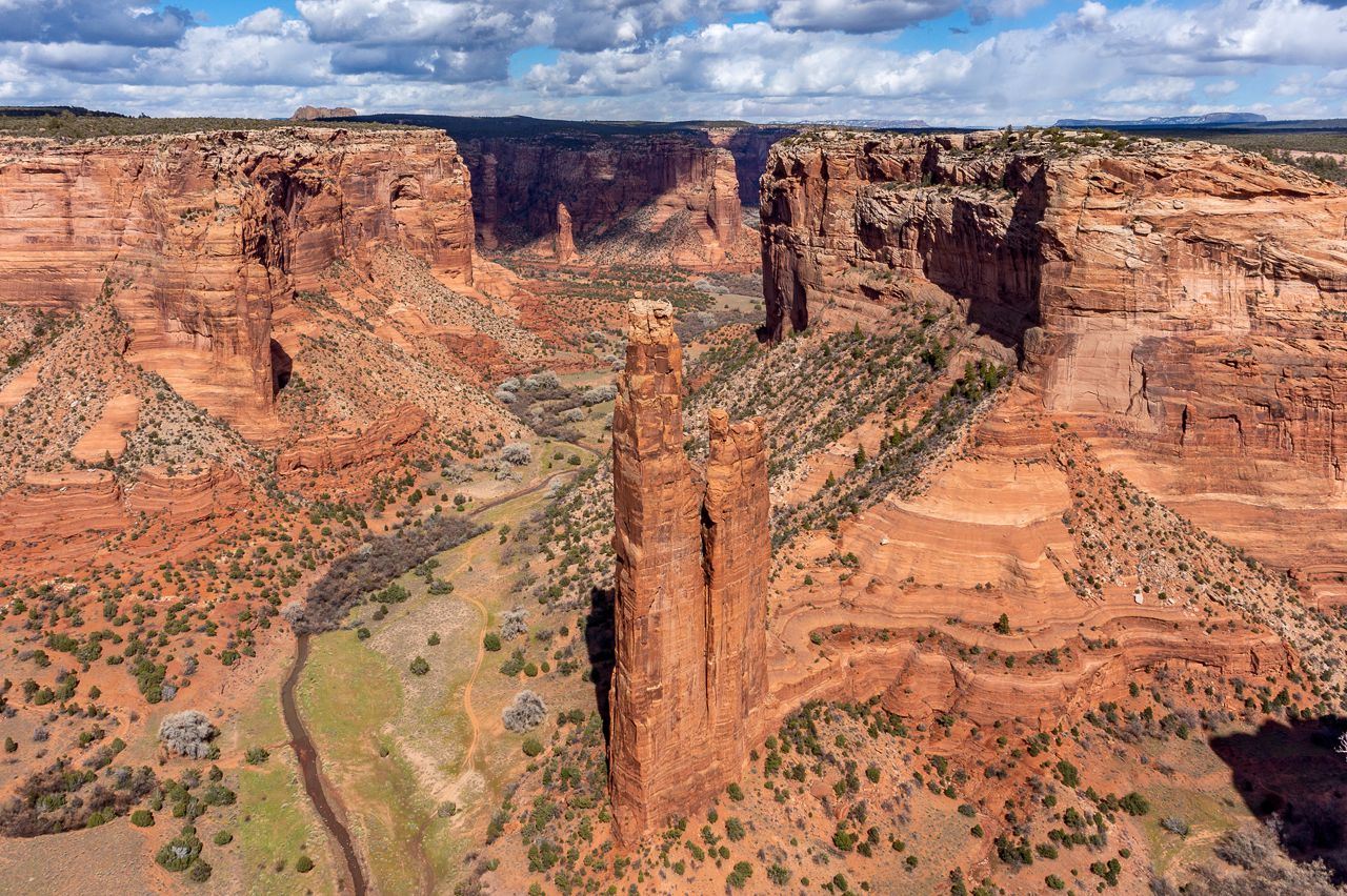
Spider Rock.  Named for a figure in Navajo Lore:
Spider Woman.

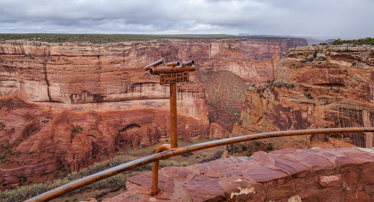
A cool feature I've not seen before in other areas where there's distant cliff dwellings:


You peer through the tube and that allows you to spot the distant cliff dwellings on the other side of the canyon.  Here's some zoom shots, must remember to use the tripod next time.


can you see the dwellings along the fissure?


Look along the fissure, above the vegetation


Fissure near the top...


Anyways, I thought it was pretty cool and handy how they pointed out the dwellings for us tourists.  I don't think I would have spotted them without a lot more effort and some luck.

Spider Rock was the last overlook so I retraced my route back to the campground.  Of course, as I left the South Rim behind, the sun came out!  Oh well, there's always tomorrow.  The forecast is for no rain, but partly cloudy and temperatures only in the low 60s.

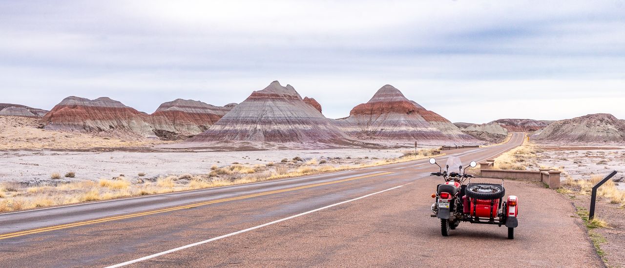
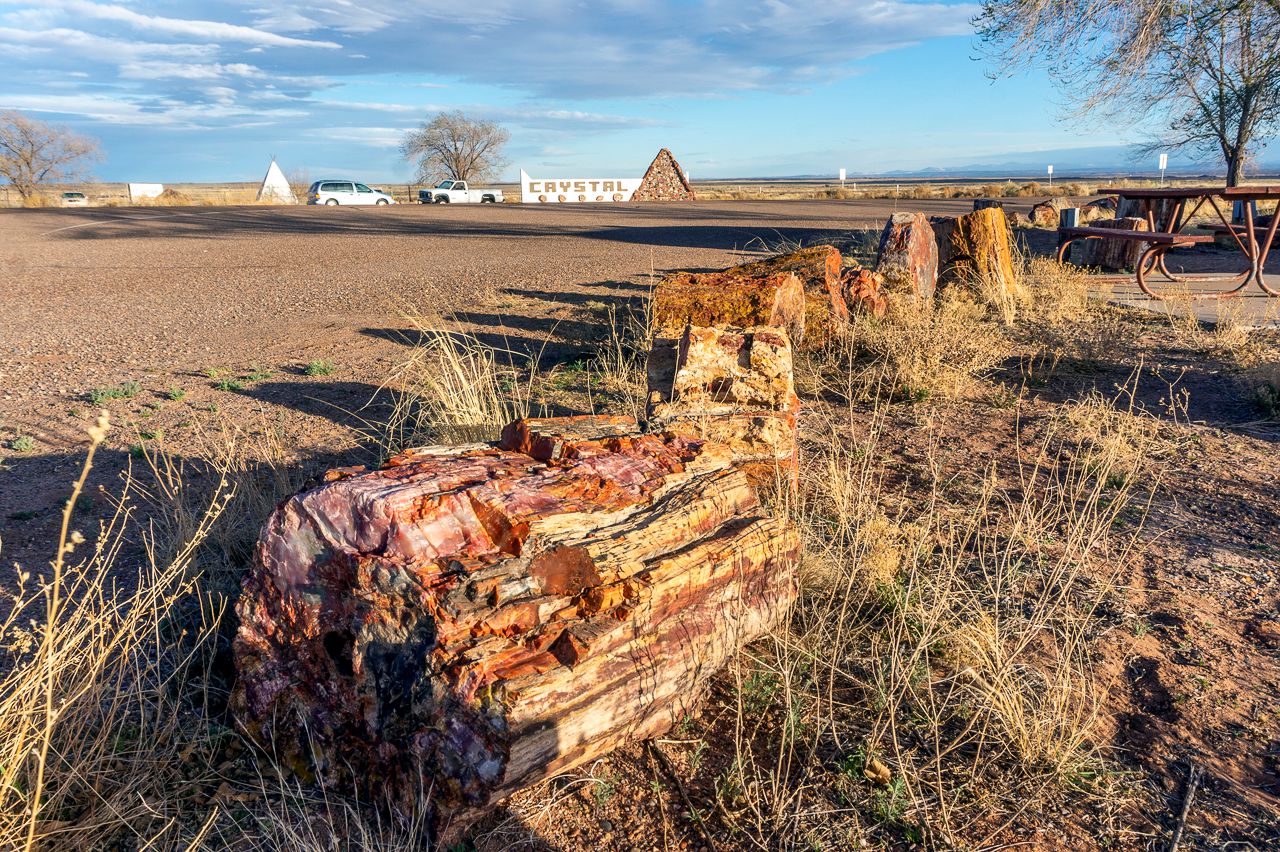
If you didn't already, check out my post on the Petrified Forest National Park, it's the posting before this one.

Monday, March 28, 2022

Displacing to NE AZ and Uraling/T'Dubing through the Petrified Forest National Park

March 27,  Sunday

The sunrise near Ajo, AZ turned out pretty good:


I left the campsite shortly after 7AM and had dumped tanks in Ajo by 7:29 AM.  It was a long day of driving, taking about a 1/2 tank of gas.  

Along the way, I transited through the San Carlos Apache and White Mountain Apache Reservations.  Nice scenery, at times it was like driving down into a smaller version of the Grand Canyon and up again.  Too bad no camp sites near or in these reservations that were obvious to me anyways.


I arrived at the Petrified Forest Museum/Gift Shop (not associated with the Park Service) a little after 3PM.

There's 6 pay sites on one side of the museum/gift shop with electricity, cost is around $16/day.  The other side has a parking lot that's free for RVs, so long as they're self-contained.  In other words, you've got a toilet inside.


If you want to just look at petrified wood trunks and such, this place uses them as border markers!  Heck, you can apparently buy petrified wood from these folks.  You can't pick up anything within the park confines by the way, but here on private property it's OK.


March 28, Monday.

It would be solidly overcast all day, with strong winds.

This is not the park you want to visit and take pictures at during an overcast day!

Perhaps I've become a bit jaded, or there were too many people around at times, but I didn't really enjoy this park that much.  Perhaps if it had been sunny, but the gloominess of the weather was too pervasive I think.

It's about 28 miles on a paved road that runs roughly north/south through the park.  The north end is on I-40 and the south end is about 20 miles SE of the town of Holbrook, AZ.  

Agate Bridge, the concrete support was put in 1917
People used to walk on top of it, not anymore.

The Tepees

Studebaker near a marker for US Highway 66


Near Pintado Point


I don't recall where I took the next two pictures, sorry.


Views along the loop for Blue Mesa/Blue Forest


There's a one mile long walking loop in Blue Mesa area, this place would be worth returning to when the light is right, perhaps during a sunrise or sunset.


Newspaper Rock:

Can't see much from the overlook, I needed to use
the zoom feature on the Sony HX80:


I think this was part of Crystal Forest, not sure:


The visitor center near the southern entrance had a nice set of dinosaur and not-dinosaur bone exhibits:


In back of the visitor center, there's a 1/2 mile or so loop of petrified logs and such.  I didn't walk the whole thing, was getting blisters from the walking I did at Blue Mesa.  I think, the below tree trunk is called Old Faithful:


Petrified wood trunk section

Mid-afternoon, I walked to the gift shop (not really a museum) and perused their wares.  Some nice stuff, a bit pricey for me, and sorry but pics not allowed.

A display outside the gift shop, guess this guy 
took on too big a souvenir!

Yep, $2 a pound folks, 10 lbs. minimum
There was a sign stating all rocks for sale were
collected on private property.

Around 4PM, the sun started to peek through the heavy cloud cover which had dogged me all day.  I got on Yagi and rode back to Blue Mesa Overlook.

The sun was shining, briefly, when I got there so I hurried for these two shots:


I then waited for perhaps 15 minutes for the next break in the clouds for this pano and series of pics:


I think you'll agree things look much better with some sunlight!  

Following two pics are of petrified wood trunk sections used as border markers in the gift store area parking lots.


Tomorrow is supposed to be cooler, overcast and with slight rain showers.  I'm thinking I'll displace to Canyon de Chelly instead of staying another day.