Saturday.
After saying goodbye to Martha as she boarded a Lyft ride into Las Vegas, I made my way out of the city via CR 215 to I-15.
Heading NE, I drove to a BLM site near Parowan Gap, about 19 miles off of I-15 from the town of Parowan.
Nice little site, had it all to myself.

Next I went to check out the petroglyphs at Parowan Gap:


Crossing the "gap", I found a small dry lake bed next to a road named Little Salt Lake Rd.

Retracing my route to catch the sunset, I paused to catch the warm colors of the rocks before the gap:

I found a nice spot for the sunset on a dirt/sand road off of Gap Road and posed Scarlett accordingly:


Greetings


Quite windy and cool but nice where the sun shone.....
Oct 20
Woke up to 30 degrees Fahrenheit and quickly had some breakfast and broke camp, glad to have run the heater last night!
I decided to check out the stretch of highway on UT 12 between the towns of Boulder and Escalante and told the GPS to take me to a BLM site close to Boulder along the Hells Backbone Road. A road named like that, it had to be checked out!
Turns out, I've been on this stretch of UT 12 at least once, coming in from the south as I did today, probably from when I rode to Bryce Canyon years ago. The curvy portion isn't much, to one's eye, if one is coming in from the south. Sure, there's curves and grades but nothing remarkable.
Its much more visually appealing when one drives the same portion coming from the North!
I found the BLM occupied by someone who appeared to be packing up. So I killed some time seeking another spot, instead coming across an old run down dirt air strip labeled Boulder Airport. Pretty sure it's no longer in use except perhaps as an emergency landing field?
Turning Uma, the URRV around, I went back the way I came and found the desired camping spot empty! It was a tight squeeze but I got Uma backed in there without having to unhook the trailer.


I rode Scarlett to Hell's Backbone Road, what used to be the mule train mail trail between Escalante and Boulder I dimly recall reading somewhere. I didn't get very far, the trail quickly became something one should not ride alone!
I then went to check out the curvy portion of UT12 called the Hogback and found it more visually appealing when coming in from the North.

Tried but couldn't replicate the shot I'd seen before, oh well.
Skyline Drive's Hogback Road is still the better road IMHO
Next I rode west on UT 12 all the way to the top of the road where one can see the whole Escalante canyon valley.
Some views as I stopped wherever possible:
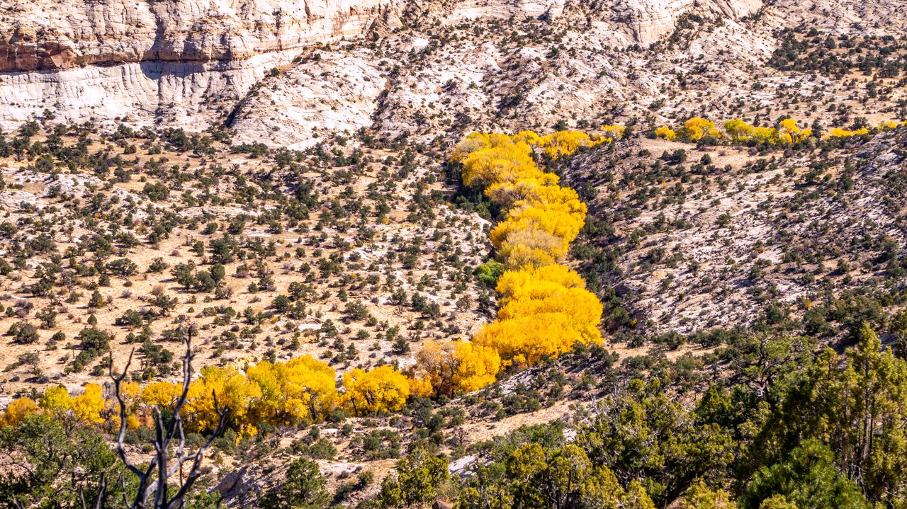
Fall Colors were peaking within the canyon


I detoured into the Calf Creek Campground, very small sites, and there's a warning re RVs over 25 ft long.

Continuing west, one eventually twists and turns his way to the top of the canyon for a grand overview of Escalante Canyon:


The overlook where you can see the above rock formation is the
furthest west I went on Scarlett.
I retraced my route back to Hells Backbone Road and settled in the for night. No sunset pictures, no clouds and lots of trees.
2 comments:
19 mlles to a boondocking site? Nice photos,
19 paved miles....1/4 mile of dirt
Post a Comment