Saturday, December 04, 2021

A sunrise, minor fixes, rock climbing, and a sunset

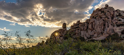
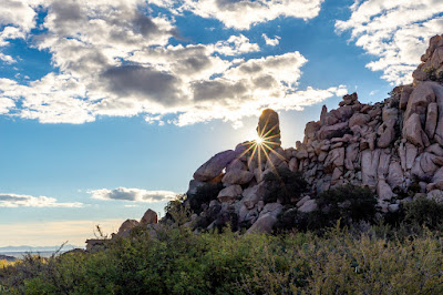
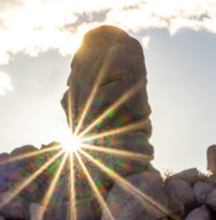
We had another nice sunrise this morning:

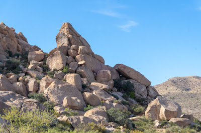
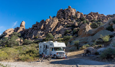
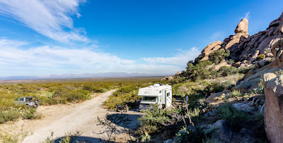
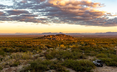
I'm going to call this camping spot: Moai Point
Moai are the ancient statues found on Easter Island

Spent the morning straightening out the metal shield located under the freshwater tank.  One corner had come loose at its weld to the frame member due to my filling the tank one time without opening the drain tube valves!  I was fortunate then to have caught it before it burst the tank!  After bending the metal back into shape using a bottle jack, I then used a metal strip and two bolts to secure the corner that had come loose.

I had originally thought it was put there to help support the water tank but realize now it is to shield the tank from rocks and such coming up from underneath.

After lunch the skies have become mostly overcast and the temperature was only 65°.

I also managed to reinstall the cushion donut under the TW's seat cover; hopefully it will help again on the long saddle days.

Repaired some ripped seams on my motorcycle boots and seal them up with some Shoe Goo.

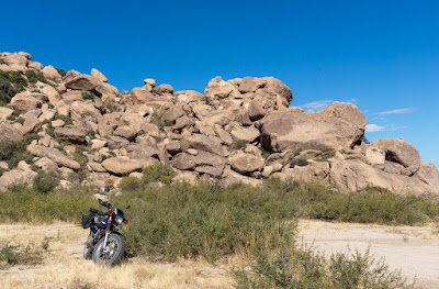
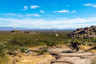
Chores done, I got on Yagi, the TW200 and decided to ride all the way to the boundary of the Dos Cabezas Wilderness Area.  It was rough going in several spots, lots of big rocks and loose rocks but Yagi with her correctly inflated tires did great!  Yes, there was dabbing and some paddling by her rider but no drops or crashes!  

Got to the boundary, marked by the fact the trail ended.  There were a couple of hunters hanging out there by their ATV and they confirmed this fact.  One of them pointed out to me the boundary marker:

I then turned around and retraced my route, pausing here and there for pictures between rough patches of trail.  Again, no drops or crashes, my lack of "style" notwithstanding.


I then meandered over trails outside the camping area, picking up trash if I spotted it.  Once I had both saddle bags full along with items strapped to the cargo rack, I went to the picnic area where the Bowie Lions provide a couple of garbage cans.

The light of the late afternoon at this point made taking clearer pictures of the probably fake petroglyphs.


I'd spotted guys on top of the big rock that is next to the picnic area, in fact I saw them descending as I finished getting rid of the garbage.  So I decided to climb up the rock to see what there was to see!  It was pretty steep but the rock is so roughly surfaced my motorcycle boots gripped nicely.

Only had to stop once and made it to the top with no issues, here's the somewhat flat top portion of the big rock I'd just climbed up:


A view of Happy Camp Road, that small mound of rocks with the travel trailer parked near the road is the spot I usually try and use when camping here.  Now that I've found Moai Point, it's become a secondary choice.


Some neat rocks on top, some perched seemingly precariously.


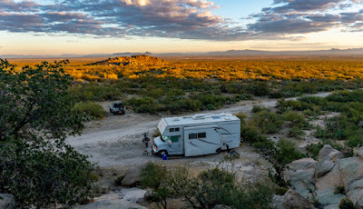
Here's a view of Happy Camp Canyon Road as it goes further in towards the Dos Cabezas Wilderness.  My campsite is around the bend where you see the road disappear.  You can see the other camper units along the road.


As always, some morons had spray painted graffiti on the rocks.  Luckily, they restricted their idiocy to only one rock that I could find.


I got back down from the top of the rock with no issues, and yes I was so focused on not falling that I forgot to take pictures of the steepness as seen from the top.

Riding back to my campsite, I passed several cows resting by the side of the road.  Here's a little fellow who contested the road with me for a few seconds before yielding.


Later on, as I was sitting inside the VRRV, two big bulls meandered by and stopped to stare at me for a while.  Not sure why the bull on the right didn't have horns.  Even some of the cows have horns with the cattle seen here, and yes, I checked for udders.


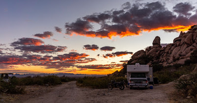
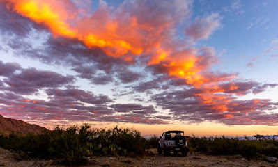
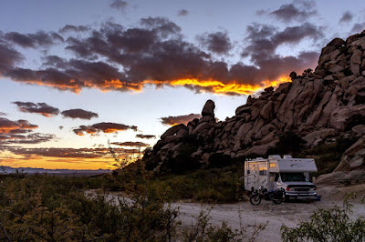
A bit later, I caught a glimpse of pink alpenglow to the east and took a look to the west.  What I saw would have me rushing up the rocks next to the campsite and managing to catch this portion of the sunset:


Note the cows grazing in the lower left hand corner.

Friday, December 03, 2021

T'Dubing to the Chiricahua National Monument

 Long day, seemingly, in the saddle of my Yamaha TW200 Dual Sport.  

The ride to the monument was only 34 miles but it felt longer.  Perhaps it was the cool wind chill factor as I motored along, perhaps its the narrow and hard stock seat, or perhaps I'm just getting old.  :)
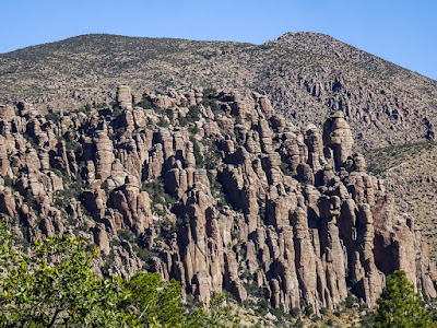
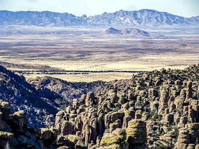
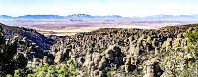
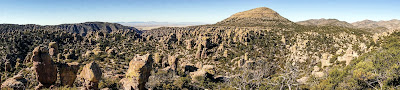
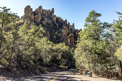
Regardless, made it to the Chiricahua National Monument with no issues and spent a couple of hours wandering where there were roads, taking in the scenic road to Massai Point and back.  I must say, the area's rock formations are very striking and very cool to see.

After a while though, one becomes a bit overwhelmed by all the cool rock formations, and it all starts to blend together.  At least it was that way for me.  Still, a nice location to check out for sure.
I also checked out nearby dispersed campsites in the Coronado National Forest but the lack of cellular data signal (hell, any signal) and the smallness/tightness of the sites I saw precluded my ever using them in the future.

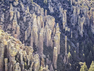
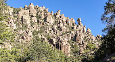
My first view of the first major formation of rocks as I motored in from the fee gate station, which wasn't manned.


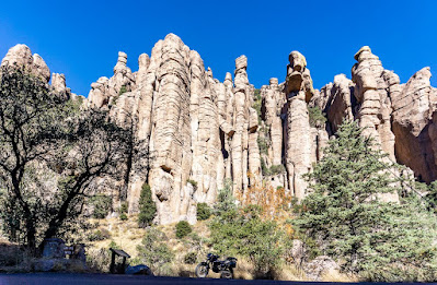
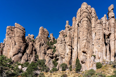
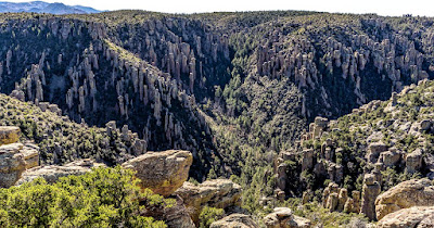
Organ Pipe formations, my favorite set of rock formations inside the monument


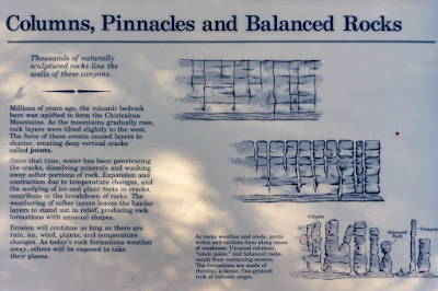
How are these cool rock formations created?  Here you go:


The scenic road is not very long, perhaps 6-8 miles, with the beginning and end chock full of rock formations.  The in between space is mostly just distant mountain views and heavily forested valleys.  

Here's some of the stuff I saw both at Echo Canyon:


and a bit further on, at Massai Point:


Note: I may have mixed the pics above as to their respective location, as I said, things started to blend after a while.


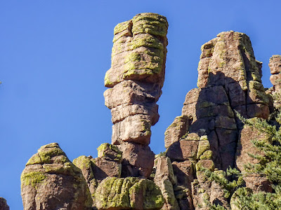
At the "Sea Captain" rock formation

"Sea Captain"?  I don't see it.

I left the monument by noon I think, checked out the campsites briefly as mentioned then headed back the way I'd come; using Apache Pass Road.

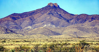
Here's a view of Dos Cabezas, now a congressionally designated Wilderness.  Dos Cabezas means Two Heads in Spanish, I think you can see why they chose this name.


Apache Pass, is the route used by the Apache raiding parties to move towards Mexico and US settlements in between from the San Carlos Reservation where they were supposed to stay.  The US Army would end up setting up several forts, one of them being Fort Bowie, to try and interdict these raids.  They would end up trying for 24 years or so, the longest war waged by the US.

There's a Fort Bowie National Historic Site which I rode by, but there's not much remaining of the fort and I doubt I'll return for the short hike involved to get to them.

Thursday, December 02, 2021

Exploring the Indian Bread Rocks Recreation Area more closely

I've been camping here before, at least twice that I can readily recall.

But of course, one can never fully get to know an area in such short periods of time.  Today, I gave it some more effort and time.  While the main objective of staying here this time around is the exploration of the Chiricahua National Monument, 34 miles away, there's quite of stuff to see here as well.

First though, we had a pretty good sunrise today:


I'll be referring to the above picture later

I rode Yagi, the TW200 Dual Sport to do a thorough exploration of the trails in the recreation area.  I went down every side trail, mapping possible future campsites when applicable covering all the motorable trails I found.


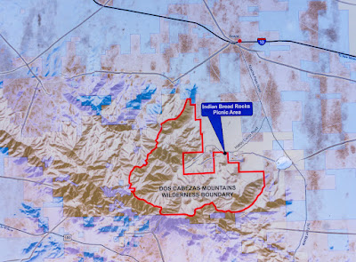
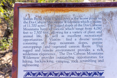
Then, I stopped by the picnic area near the entrance to the campground.  There was an information sign there I'd not seen before:

Dos Cabezas, by the way, means Two Heads in Spanish


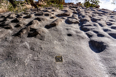
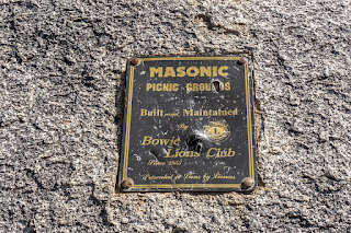
Next to the picnic table area, there's this large weird looking lumpy rock.  It's appearance and the small bronze plaque on its side caught my eye.  I wondered then, if this was the "Indian Bread" rock that gave this place its name.  That question remains unanswered.

Can you see the Masonic symbol above the plaque above?


Near the plaque, there were what appeared to be petroglyphs.  I've my doubts as to their authenticity as there was no official mention of them anywhere I could find.  Most likely some fool's idea of a funny joke or something.


On the way back to the campsite, I took a picture of the back side of the "Maoi" rock:


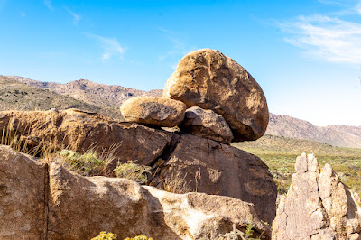
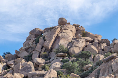
In the early afternoon, I did some walking and climbing where possible to get close to some of the precariously perched rocks that are visible from the VRRV.


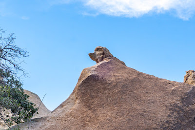
Now, for the word of the day: Pareidolia.

Pareidolia is the tendency for perception to impose a meaningful interpretation on a nebulous stimulus, usually visual, so that one sees an object, pattern, or meaning where there is none. Wikipedia

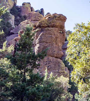
Here's one of the rock formations that inspired the word of the day for me:

I see the head of a dog, do you?

Now, remember I said I'd referenced the seventh picture from this morning?  Here's a closeup of the feature in question:


At that particular moment, I saw a face, the horizontal slot forming the right eye, a very small flat nose and what looked like a mustache above a closed mouth.  Do you?

Anyways, a very relaxed day overall.  Been doing some reading, some Youtube viewing on differing subjects and some podcast listening as well.

Wednesday, December 01, 2021

Now boondocking at the Indian Bread Rocks Recreation Area BLM campground

 I left the Dragoon Mountains shortly after 8AM this morning, stopped at Benson, AZ for groceries and cleaning supplies at the Walmart and then headed east on I-10 towards Bowie, AZ

Stopped at the TA Travel Center and paid $10 to dump tanks, then drove on over to the nearby KOA Campground where I got water.  Surprisingly, it was no charge.  Wonder how long that will remain the case.

Anyways, kept going east on I-10 for a short while and turned off the exit for Bowie, AZ and from there it was less than 8 miles or so to the BLM recreation area.  The road is dirt, a bit wash boarded but take it slow and its fine.

The site I'd stayed in before was taken.  Figures, it's a nice site and all by itself.  I kept going into the campground itself and parked the VRRV to conduct a recce with the Sammy.

I soon found a nice spot away from the main camping area where most of the other campers are; there's perhaps 8 others, maybe 10.  The site I found has no other sites within sight of it and there's a bit of rocky road to get to it so hopefully it'll dissuade some others from coming down the road.


Good cellular data signal, better than the Dragoon Mountains location so far.  The plan is to stay here at least a week, maybe longer.  We'll see.  As you can see, lots of rocks to climb around and explore in the immediate area.

The Chiricahua National Monument is about 34 miles away according to Google Maps so I hope to explore that as well.  Maybe do a recce for campsites closer to it which are listed on allstays.com but what reviews there are sound iffy.