It had been quite a while since I'd visited the town of Montezuma, roughly south of the Arapahoe Basin ski resort. In fact, I got apparently confused thinking that I'd missed a cliff side dwelling associated with the name Montezuma, but alas, that turned out to be somewhere else.
Still it was a pretty good day of riding, temperatures never fell below freezing even at the summit of Loveland Pass and most of the time in the mountains was spent with temperatures in the mid-40s Fahrenheit.
Scarlett and I motored out of the home neighborhood by 7:15 AM and it would be almost 9:45 AM before we made it to the junction of US Highway 6 and Interstate 70! Traffic was slow/go and stop/go from before Floyd Hill all the way to the junction of I-70 and US Highway 40! Just a lot of cagers, some of the them heading to the ski slopes, some folks heading into the mountains to hike and play.
As Montezuma was the primary reason for the ride, and the sun was not in a good position to highlight the mountains peaks visible while transiting Loveland Pass; I only stopped once along US 6 at the usual spot overlooking Seven Peaks and the Arapahoe Basin Ski area.
Near the A-Basin ski resort
Scarlett and I proceeded west on US6 until we reached the outskirts of the Keystone ski resort. Turning around, we got on the exit for the road to Montezuma. The road was pretty much empty, and mostly clear though there were patches of packed snow and ice in the shady areas. Not a road I'd take a two wheeled motorcycle on, with my lack of off road skills.
Of course, on Scarlett, no problem! We got to the town of Montezuma with no issues and found all its streets still snow-covered/packed. I'd read the local sheriff and his deputies were strictly enforcing the speed limits in town but the snow ensure one took one's time regardless.
Transiting through this small town, past three barking dogs, took very little time and soon I was at the trail head where I had to turn around last time. Today would be no different, the snow had been cleared but only to the width of perhaps the rig or a snowmobile and conditions looked iffy.
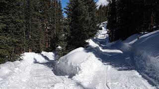
So I turned around and explored up a different road I'd seen, advertised as the way to Webster's Pass. This proved to be a snow-packed narrow road which forced the use of 2WD on the part of Scarlett. Still we made good progress going uphill but soon ran into this:
Above picture shows you the quality of the "road" towards
Webster's Pass
I spotted the "Private Property" and No Trespassing signs and
decided at this point to turn around.
I have a feeling the private property is on the sides of the road, not
the road itself but today was not the day to find out.
The turning around point.
Scarlett's clutch cable developed a lot of slack while I took the above pictures, very strange. But I was able to put the cable back into adjustment after making sure the cable had not broken somehow. Scarlett and I motored out to the main road with no further issues and headed back to the trail head to get a picture of the peak:
Looking back towards the trail head
Montezuma's Church
Standing near the church, looking back towards the nearby mountain.
Quaint little town, Montezuma, but after the above riding around, not much else to see so we motored on back towards the Keystone ski area and from there turned west towards the Breckenridge ski are. We turned off onto Swan Mountain Road before we reached Breckenridge to get a shot of the Dillon Reservoir/Lake.
Dillon Reservoir/Lake
Ice Fishing
The houses on the ridge sure have a nice location don't they?
Riding back towards the summit of Loveland Pass, Scarlett and I stopped fairly often whenever we found a safe spot as the sun was now lighting up the mountains quite nicely.
Another shot of the ski slopes of A-Basin ski resort
Seven Peaks
Climbing towards the summit, looking back towards the west
The summit was full of skiers, snowboarders, tourists and cars so Scarlett and I didn't linger there. We rode all the way down the east side of the pass to the first major hairpin turn where we turned around to get pictures of the scenery visible as one goes to the summit:
Clouds moved in sporadically, making it appear gray near the summit
but it was mostly blue skies overhead everywhere else.
Pictures done, we motored back down towards the east end of Loveland Pass Road, past the Loveland Ski area facilities and soon Scarlett and I were motoring back towards the Metro Denver area.
I refueled Scarlett at the Valero gas station in Georgetown (32.9 mpg) and from there took the frontage road towards Downieville where we once again picked up I-70. Traffic was about medium, but moving quite fast so clusters of cars just kept passing Scarlett and me.
Got home via the I-70 to C-470 superslabs and chose to use Parker Road as the way to get me back towards the home neighborhoods. No issues, no idiot cagers trying to kill me, good weather and good picture opportunities.


No comments:
Post a Comment