Sunny day with some noticeable but not bad winds.
Martha and I drove over to the Capitol Reef NP's Visitor Center located just off the UT24 Highway about six miles east of Torrey, UT.
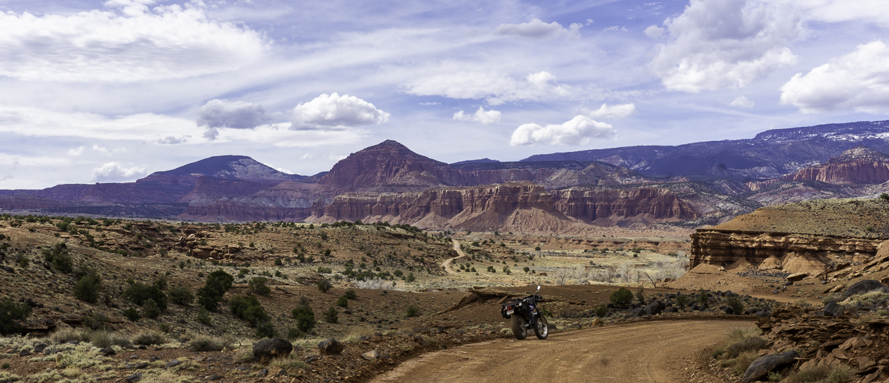
After getting her Park Passport book stamp and a map, we drove onto the Scenic Highway deeper into the park. First, a stop at the Gifford Farm where a museum and store is located. Mainly, to get a pie sample.
The drive into the scenic highway's rock formations was "into the sun" so we didn't stop for pics or use any of the dashcam video footage. We got to the end of the road where there is a small trailhead. Parking was an issue and we ended up parking in a small spot at the end of a line of parking spots. When we returned it was a cluster-f*ck of a parking area.
The Capitol Gorge Road trail is pretty level and we walked about a mile in, I think you can take this trail all the way to the small town of Notom, UT but we wouldn't be going that far.


The gorge is obviously by definition bordered by high rock walls. We were walking where water once flowed (and probably does during floods and heavy rains).
We walked past Pioneer Register where people from the past left their mark and names while transiting this area. There's also a bunch of modern era ass wipes who left their names on the rock walls. I guess they didn't see the sign stating it's illegal, after all what's historical value compared to a fleeting Instagram posting right?
Anyways, we got to the start of The Tanks trail which led up some sketchy looking terrain:

Martha of course was up for the challenge and up we went. It was signed as 0.2 miles long, the trail. It wasn't too bad but some parts required due care.
Still we made to within sight of "the tanks". You can see water collecting in one of the pictured holes below.


6 comments:
I have heard of Capitol Reef and really want to visit. It looks so fun and interesting. The road looks like a good adventure.
Oz, it's a nice little park, and under good light, gorgeous...besides the scenic road, it's all hiking trails.
Did wagon trains once use those trails or were they stictly for horseback or walking?
Interesting photos you captured.
CCjon, I believe the road was used by early settlers to get past the "reef" barrier which later became part of Capitol Reef NP. The Capitol part was a rock formation named because it reminded people of the US Capitol at the time I think.
My heart belongs to Utah. Loved the drive in Capitol Reef. We didn’t hike as we were time crunched, but the drive was beautiful. I can’t wait to go back to that area. Thanks for the lovely pics and video. Brought back memories.
You're welcome Bluekat....
Post a Comment