After a previous attempt back in 2012, finally made it to the top of Engineer Pass near Lake City, Colorado!
My first attempt was on my 2011 Ural Patrol, Valencia. It didn't end well and I ended up with a clutch pack that had to be replaced! Got me home, mind you, but it was toast. LINK to that "adventure"
Today I made it to the top, riding Yagi, my 2006 Yamaha TW200 or T-Dub. We took the easier of the two routes up to Engineer Pass, starting from Lake City, CO instead of the previous attempt start from Ouray, CO. (The much harder route apparently, something I'd not known back in 2012).
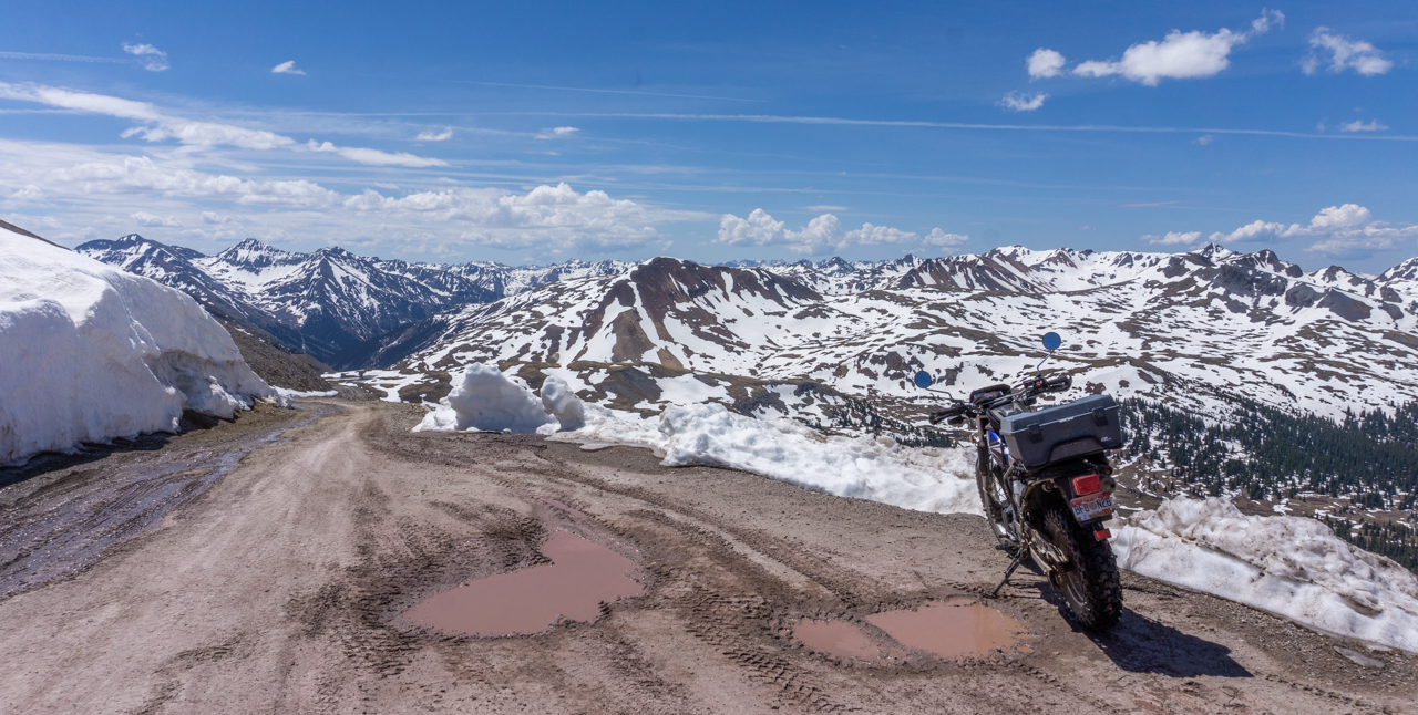
It's an 18 mile ride from Lake City to the top of the summit, the last four miles being road conditions where 4WD was recommended. Yagi handled it all with aplomb, didn't drop her once and only stalled her once on an incline when I failed to power out of a tight switchback turn.
Here's some pics on the way to the pass, riding on Lake CR 20, or the northern half of the Alpine Loop.

At about Mile Marker 10

At the junction with the "road" leading to the Golconda Mine
The last four miles were tricky but really nothing Yagi couldn't handle! Soon enough I spied the sign at the top and powered on all the way up! Success!

Pictures from the summit sign area:


See how the road goes up a little more? I would head up that
way for perhaps a mile.


Then, I saw an offshoot trail heading out to what was called "Oh Point". Nice place for more snow peak pictures:


Returning to the summit sign area, I started back down the way I came up, heading back towards Lake City. Some of the views on the way down:


Somebody really prized solitude to build a cabin this close to the summit

Back down at mile marker 14, note the signs
Soon after I returned, Martha and I set out to explore some nearby National Forest campgrounds for future reference. We found that Mill Creek would be suitable in the future. We rode CR 30 till it split off to go up to Cinnamon Pass on the right and the remnants of Sherman, an old mining town on the left.
We didn't go very far towards Cinnamon Pass before it got iffy so we turned around and went over to Sherman. Not much left to explore there except some piles of wood that used to be houses so we didn't really spend much time there. We returned to the campsite soon after.
Here's a shot of the rocky peaks visible along CR30:

8 comments:
I have been over Engineer Pass in a jeep. It is a beautiful area. One day I will have to ride it on a motorcycle.
Thanks for the comment Oz, jeeps....followed by ATVs appear the popular choice for these kinds of trails.
Nice work Dom. Looks like it was worth the trip. My little WR would love that sort of country.
Thanks Andrew, the Mighty Mouse would probably race up to the top of the pass!
Oh my, the panoramas, Dom. Breathtaking. I miss snow covered mountains... We hope to be able to travel a bit more (the Alps are calling...) come July.
Thanks SonjaM, I miss the more impressive looking Alps .... looking forward to your continuing pictures of them as you travel.
Gorgeous open vistas of the mountains. And the last one, what a lovely spot to call home.
Thanks Bluekat, am sure that lovely homesite could be had for a couple million, tops!
Post a Comment