Sunday, December 31, 2017

Happy New Year!

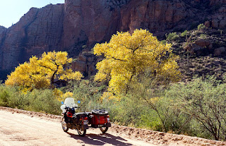
Another year has come and gone, several trips, many changes, a year older though I wonder about the wiser part.   :)

Here's hoping 2018 is a great year for you and yours!  Thanks for sticking with the blog and my meanderings.


Total mileage ridden in 2017: 10,272 miles broken down by motorcycle:

Scarlett:  Ending odometer reading 51,607.  9938 Km or 5962 Miles

Brigitta ('87 BMW R80): Ending Odometer 99,714.  1298 Miles (Still Pitiful)

Fiona: Ending odometer: 4674 (odometer replaced at 19777), 5021 km or 3012 miles.

RV Stats:

We went glamping with Umarang, the URRV, for 72 days.  She took us Utah, Nebraska, South Dakota, Wyoming, New Mexico, Arizona and several spots around the great state of Colorado.

Monday, December 25, 2017

Merry Christmas!

Here's hoping you and yours have a Great and Merry Christmas!


and from Christmases past....

Wednesday, December 20, 2017

RV Trip: Day 8 - Uraling to Apache Lake

Scarlett and I rode up AZ Highway 88 past the Lost Dutchman State Park (it's really designed for hikers, not riders and so I skipped going inside the park.

The road past the park is in pretty bad shape, there was frost heave damage every few feet along this road (which is why there was construction crews clogging traffic up); all the way to Tortilla Flat.

Tortilla Flat is a small "town", population 6, smallest one in AZ with its own post office.  It's the last remaining Stage Coach stop from back in the Apache Trail days.

Ironically, the pavement became "smoother" once past Tortilla Flat, no more frost heave damage.  Of course, the pavement soon ended and it became a dirt road with wash boarded sections but otherwise not too bad.

Full of twists and turns too, you have to be careful and watch your line.  The scenery is a bit mild and the highlight before arriving to Apache Lake was the Fish Creek Hill Road which one uses to dive down into the canyon below.

In fact, there used to be a Fish Creek Hill Challenge back in the earlier days of motorcars; where drivers competed against the clock for the fastest climb up this 10% grade hill.

For the record, Scarlett did it in 5 minutes 10 seconds.  As I doubt there's been another Ural on this road, I'll claim the record for this class!  :)

 From near the top of Fish Creek Hill

 Working our way down Fish Creek Hill Road

 One passes Canyon Lake on the way to Apache Lake

 Near the "beach" at Apache Lake.

There's a lodge and a small RV campground at Apache Lake, they even had Extended 3G Internet (slow).  After perusing the lake's views I saw that it was another 17 miles of dirt road to the Roosevelt Dam.  It had been 14 miles and 90 minutes from Tortilla Flats to Apache Lake so I decided this was my turnaround point.
 Hey look, Fall Colors!

 A nice spot for a break for both myself and Scarlett.

 Stopping at the store in Tortilla Flat where I got
a drink of Snapple.  The restaurant/post office
is next door.  Not much else to the "town".

We made it back to the vicinity of the Lost Dutchman State Park and I found a spot outside the park to pose Scarlett by with the Superstition Mountains in the background:
 Superstition Mountains

Got back to the Usery Campground and worked on Scarlett, minor things that needed attention.  She's also starting to have sporadic issues with the kill switch I think.  It won't engage the starter so I have to kick start her.  I checked the switch, re-seated all the fuses; now I can't get it to do it again.  Sigh.

Then it was time to do a test drive after messing about the steering head area moving wires around.  (Tank bag strap had started interfering with steering, not good).

Test drive went well, she turns much easier now that I'm not fighting the friction induced by the tank bag neck strap having become wedged where the steering stops are located!.

Plenty of time to find a different spot for sunset pictures, this time using the Blevin Trail Head Parking Lot to catch the sunset.


The last picture was back at the campsite, same cactus as yesterday's sunset but this time using a 20 sec long exposure so I could force the use of ISO 100; came out OK I think.


Tomorrow I resume my caregiver duties with my FIL until the 24th when I hit the road back to Colorado; hoping to be home late Christmas Day.

Tuesday, December 19, 2017

RV Trip: Day 7 - Bush Highway and Usery State Park

Tonight, we're in the Usery State Park camping ground, luxuriating with electrical and water hookups. 

Got the old front tire with new inner tube back on Scarlett with no problems.  It held air just fine and it was good to have a spare tire again mounted on the trunk.

Of course, a test ride was in order.

After work, it was a ride up AZ State Highway 87 to check out reported scenery on the way to Payson, AZ.  Unfortunately, the rumored scenery must have been closer to Payson and I didn't have the time.  So after posing Scarlett with the Four Peaks mountain range in the background:

At the Four Peaks Recreation Area

Scarlett and I turned back south on AZ87 and turned off at the exit for the Bush Highway which sort of led back towards the camp site.

In the area of the Saguaro Lake Recreation area, I found several nice places for pictures:

 Saguaro Lake and its gorgeous rock walls


I got back to the campsite with no issues using Usery Pass Road and wandered about checking out the large amount of cacti prevalent all over the park area.


Lucky for me, the spot I ended up camping on was perfect for catching today's sunset:


Monday, December 18, 2017

RV Trip: Day 6 - Schnebly Hill Road and my first flat front tire.

After work I had to run down to the town of Cottonwood which is located south of Sedona, about 18 miles or so.  Why?  I'd bent the key to the outside storage containers and I of course left the spare keys at home.

Note to self: carry spare keys not only for the motorcycle but for the RV too!

Home Depot was where I'd bought the replacement locks from before (replacing the ones that came with the RV since they're all keyed the same across many, many RVs).  They had the same locks but not the right key code.  Dammit.

Luckily, their key making person was able to find suitable blanks and used my bent key as a guide, success!  I got two.

I then rode back out to I-17 from Cottonwood so that I would tackle the rocky road called Schnebly Hill Road from the top and would be going downwards to the town of Sedona, 12 miles away.  It would turn out to be a long, long, long 12 miles!

Sure, I could have started on Schnebly Hill Road from Sedona but then it would have been uphill all the way.  My Ural likes downhill better.

The first few miles of Schnebly Hill Road are through a thick pine forest and the road isn't too bad, not something I'd take a regular car or the RV on but not bad.  It would however get worse, much worse.

 One's first scenic view once clear of the pine forest
on Schnebly Hill Road

I reached Schnebly Hill Vista point where others that had arrived in ATVs, side by sides, and a pickup truck were taking pictures.  By the way they were smiling and pointing at me, you'd think they'd never seen a sidecar rig before!

Or perhaps they were thinking: "what kind of fool brings a sidecar motorcycle down this terrible 4x4 road?"

 Views from Schnebly Hill Vista


I kept motoring downward, thinking to myself that I was finding it harder to turn the front wheel.  I attributed it to a failing steering dampener at  first; so I kept on going:


Perhaps less than a half mile later, I stopped Scarlett at the point below for pictures.  It was then, as I walked back to her, that I saw her front wheel was flat!

 Not a bad spot to have a flat tire eh?

On the 2014 Ural models, the spare wheel/tire is the same as the pusher wheel in that it's got the shorter spokes to support the larger stresses undergone by the pusher wheel.

So if you go to use the spare tire on the front, some adaptation is required.  First, you have to remove the brake caliper and tie it off out of the way, the pusher wheel's disk brake isn't interchangeable due to hub size. (Front wheel has longer spokes).

So I got the wheels swapped out, front brake caliper tied off by the steering dampener and everything tightened up:

 Brake caliper tied up next to the steering dampener

 No spacer needed that I could tell....

The whole swap took 35 minutes, not too shabby.  I couldn't secure the front wheel onto the spare tire rack though, so I stuck it in the sidecar.  I called Randy, the Ural dealer I go to, and he theorized one has to remove the brake disc first!  Doh!

Anyways, Scarlett and I carried on downwards towards Sedona, it would be a slow and very rough/rocky 5 miles or so down to the city!  I was a bit nervous as you might imagine, what if I had another flat!  Then I'd have to break out the tire irons and spare inner tube while on the trail!


Finally the last mile or so smoothed out somewhat, before that, it was tons of loose rock and dips and holes and dirt.  Fun.

Got into the city, and while motoring, called the local moto shop.  They wanted $75 labor plus the cost of a new inner tube (they don't use customer-supplied ones) so I thanked him and decided to do it myself.

Got back to the campsite with no issues though the steering felt a little funny, am guessing it's the shorter spokes, heavier hub.

As the sun set, I swapped the inner tube (found a small pinhole on the side of the tube but no visible damage on the tire itself) and using both the Baja NoPinch tool and tire irons, got the Duro 308 back on.  It was still light as filled up the new inner tube and did a pressure test.  Good!

Tools packed away and now resting from all this adventure.  If the tire holds pressure through the night, I'll swap it back in at my next camping location.

Schnebly Hill Road is definitely in the top five mountain "roads" that I've ridden in terms of tough conditions!  All those large and loose rocks....it made for interesting times, too interesting at times.

Sunday, December 17, 2017

RV Trip: Days 4 & 5 -Boondocking near Sedona

Saturday, I drove Uma (with Scarlett in trailer) back towards the Phoenix Metro area.  I skipped the main portion by using Highway 303 to I-17 north.

I found a good boondocking spot, thanks to the allstays.com app, on Bloody Basin Road.  It was about 45 minutes south of Sedona so close enough for a day move.

Good 4G reception in the spot I found, though there was a bit of jockeying the URRV and trailer around until I found a level enough spot.

My nearest neighbor was about a mile away. 

I drove Scarlett around for a bit, as it was late afternoon, selecting a site for sunset pictures.

Here's a couple taken on the site selected, a small ridgeline with a couple of fine camping spots for RVs, so long as you're willing to drive on rough road to get to them!


There was a Class A RV at the lowest camping site
on the ridgeline.  He found a nice location eh?

I retraced my route back to my own campsite, stopping briefly at the site of the Cordes Ranch (est. 1883).  It's now an abandoned looking settlement.

Cordes Ranch, AZ

I made it to the RV for some tasks, then rushed back to the pre-selected site, nearly missing the setting sun.


The night was dark and quiet in my camping spot.  Though occasionally a car or truck would drive by from the west, heading towards the I-17 junction about 4 miles away.

This traffic ceased after 8PM, or at least, I quit hearing it go by.  Did I mention it was really dark and quiet?  I went to bed soon after 9PM and slept pretty well till 2AM, read for a bit then slept till 6AM.

Sunday was spent first displacing to a campsite on Forest Road 618 which one can reach from the exit to State Rd 179 off of I-17.  Almost six miles along, found a nice and big enough pull through site and got setup.  4G coverage was again excellent.  

Later, Scarlett and I rode to Sedona, checking out the colorful and large rock formations all about the city and also checking out Oak Creek Canyon.


Oak Creek Canyon had been advertised as a worthy peer to the Grand Canyon by the tourism board.  To them I say: Meh.  I found it unimpressive.  Perhaps if the sides of the canyon walls weren't covered by pine trees.  Perhaps I'm just jaded.

 Oak Creek Canyon

 Some of the hairpin turns which caused any
RV over 50 ft long to be banned

Back in Sedona, I wandered about neighborhoods along State Road 89 for some more rock formation shots.


Very nice rock formations mind you, but I was chilled from riding in the 50s without adequate wind protection or warming layers.  Silly me, I know.

I rode back to the campsite and witness a rather drab overcast and cloudy sunset.


The strong 4G reception I'd experienced at the Coconino Forest site in the morning when I moved in; proved slow and sporadic when I returned in the afternoon.  It's stable as I type this, hope it remains this way or I'll have to displace tomorrow.