Friday, June 12, 2020

T-Dubing/Clearing Red Mountain Gulch Road and some more views of Lake San Cristobal

June 7, Sunday

Today I would ride up the nearby Red Mountain Gulch "Road", a county road, to see what I could see.  It would end up being a bit more work than I'd figured on!

But first, a shot of a big grove of Aspen Trees on Hinsdale County Road 56 from Saturday evening as I rode about fruitlessly for a good sunset spot:

 County Road 56, steep one.  Closed for road work so didn't go
past this point.

Red Mountain Gulch Road is a 4WD recommended road as it starts steep, rocky and rutted right off its junction with Hinsdale County Road 30.  Yagi of course had no issues transporting me up and the only times we stopped were to clear the way of fallen trees from yesterday's wind storm.

The first two obstacles were so inconsequential I didn't even take pictures.  I did start taking pictures with fallen tree #3 though:

 Not much, easy drag over to the side of the trail.

The next obstacle tree was much bigger and thicker of branches!  No way I was going to move it so instead I spent some time removing the branches underneath the trunk; creating a small tunnel to push Yagi through:


Further up the trail, it was a fallen Aspen Tree which blocked the way.  I ended up breaking off and removing the top most branches, some dragging of the main trunk, creating a cleared path to ride Yagi through:

  Before

 After

A little further on, I cam to a good picture taking point along the trail.  Leaving Yagi trail side, I walked a bit further onto the bare rock strewn slope for this shot:


More riding and another big Pine Tree presenting an obstacle.


No way to tunnel underneath like the last pine tree so instead I was able to break off and remove the thinner branches at the top of the tree, creating a narrow path through which I was able to ride Yagi past the tree:

Almost to the top, I came upon the final set of obstacles.  The ones that would end up stopping me, two fallen Aspen trees.

I went to work, thinking I'd remove the first thinner tree so I could then try and guide Yagi up and over the lowest portion of the thicker tree trunk:


Hard to tell in the picture but the remaining trunk was diagonal across the trail and no way to move it, too heavy and the top was wedged between two other tree trunks anyways.  I tried bumping Yagi's front tire on the trunk but no joy.  It couldn't get a grip on the Aspen's smooth bark and I wasn't about give it a lot of throttle to try to overcome it!

Had I been with other riders, there was a very sketchy way around the tree trunk on the right but the potential to drop the motorcycle on a sloping slick surface was too much for me today.

So I declared victory, turned around and started making my way back down the trail.

Here's another view of the pine tree obstacle where I had to create a small tunnel under the trunk to slip Yagi through while holding onto her on foot:


That wind storm yesterday, sure caused issues on this road, I imagine the road crews of Hinsdale County will be busy this coming week as I think this road wasn't the only one now sporting fallen tree obstacles!

Some views on the way down:


Back safely on County Road 30, I rode it into Lake City to get some groceries.  Having passed it several times, I finally stopped to get a picture of the big fish at the town's gas station:


Not sure what the idea of the fish is.

Then I headed back towards Lake San Cristobal for some pictures of the wind swept lake.  Yep, it was windy today as well but not as bad as yesterday.


 View along Hinsdale County Road 33


The small island on the right, below, is linked by a small bridge to the larger hill shaped peninsula of land which forms part of the lake's marina.  I believe the bigger mound is called Texas Point.  It's for sale as I type this, for a measly 1.5 Million.


Rest of the day was spent blogging, processing pictures and just relaxing.  I'll be displacing on Monday back towards the Leadville Area.

Wednesday, June 10, 2020

Uraling to Slumgullion Pass and visiting the Alferd Packer Massacre Site

Friday, Jun 5

Martha had decided to wait till Saturday to rejoin me here in the Wupperman Campground near Lake City, CO.  This meant I had the day to myself, so of course, some riding was involved.

Easy riding today, it was all paved highway, nicely paved highway too.  CO Hwy 149 is in good condition and lightly traveled.  I rode Fiona out of the campground on Hinsdale County Road 30 until it junctioned with CO Hwy 149 and I turned south.

I made a quick stop along the way at the Lake San Cristobal Scenic Overlook.  A short walk and one is presented with a nice view of the lake:

Lake San Cristobal

About ten miles later, I was at the summit of Slumgullion Pass:

Those are the San Juan Mountains

 Uncompahgre Peak

 Sunshine Peak on left, Redcloud Peak middle and Red Mountain right

Wetterhorn Peak left, Uncompahgre Peak middle and Crystal Peak right
This view from the Windy Point Scenic Overlook

Making my way back to Lake City, I stopped at the memorial site for the Alferd Packer Massacre.  Also known as Colorado's Cannibal, it's quite the tale of desperate survival back in the day.

More on Alferd Packer here:  LINK


The site is pretty small, basically a tiny parking lot, a couple of signs (weather beaten and faded), a memorial plaque and some small crosses.

Here's some closeups of parts of the signs that weren't too faded:


This carving gives Alferd a bit of the "Helter Skelter" look

Source: Denver Public Library


Back at the campground, I checked out one of the other interesting campsites, maybe we'll get this one next time we're here:

Site 21

Monday, June 08, 2020

T-Dub'ing to the summit of Cinnamon Pass and riding near American Basin

Thursday, June 4

Another good day of high mountain trail riding.

Martha is at home in Centennial taking care of some appointments so it was just me today for riding.  I rode on Yagi, my 2006 Yamaha TW200 or T-Dub along Lake County Road 30 towards Cinnamon Pass.   It turned out to be just shy of 20 miles to get to the summit.

Having ridden the Engineer Pass Road recently, I was able to compare their conditions easily.  Engineer Pass Road is much better maintained, and with less loose rock as one nears the summit.  Cinnamon Pass' road was rockier and thereby a bit more technical.  If you've only got time to do one pass, go for Engineer Pass, much more scenic up at the top!

Some shots on the way to the summit:


Water Crossing!

The ride to the summit proved uneventful, though rocky.  Soon, it was time for pictures with the summit sign:


 I only had the short lens with me when I discovered this Marmot

 Looking back the way I came, from the summit of the pass

 Looking towards San Juan County


I laboriously climbed the hill next to the pass summit, to get this shot:


Back on Yagi, I rode a little further into San Juan County but stopped at this point for a shot, not choosing to go further based on the clouds and lighting:


Some shots as I headed back down towards Lake City:


As I neared the main part of Lake County 30, I saw a nice view of American Basin:


I turned Yagi onto the access road to American Basin:


But I didn't get very far, it's snow packed past the water crossing which I didn't try as it was flowing quite swiftly!


So I retraced my way back to camp, stopping only once more to get a shot of what I believe is Red Mountain:


Another day, another pass....

Saturday, June 06, 2020

Finally, rode up to the top of Engineer Pass!

Tuesday, Jun 02

After a previous attempt back in 2012, finally made it to the top of Engineer Pass near Lake City, Colorado!

My first attempt was on my 2011 Ural Patrol, Valencia.  It didn't end well and I ended up with a clutch pack that had to be replaced!  Got me home, mind you, but it was toast.  LINK to that "adventure"

Today I made it to the top, riding Yagi, my 2006 Yamaha TW200 or T-Dub.  We took the easier of the two routes up to Engineer Pass, starting from Lake City, CO instead of the previous attempt start from Ouray, CO.  (The much harder route apparently, something I'd not known back in 2012).

It's an 18 mile ride from Lake City to the top of the summit, the last four miles being road conditions where 4WD was recommended.  Yagi handled it all with aplomb, didn't drop her once and only stalled her once on an incline when I failed to power out of a tight switchback turn.

Here's some pics on the way to the pass, riding on Lake CR 20, or the northern half of the Alpine Loop.

 At about Mile Marker 10

 At the junction with the "road" leading to the Golconda Mine

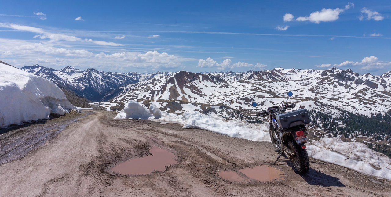
The last four miles were tricky but really nothing Yagi couldn't handle!  Soon enough I spied the sign at the top and powered on all the way up!  Success!


Pictures from the summit sign area:


 See how the road goes up a little more?  I would head up that
way for perhaps a mile.

After pics at the summit sign, I rode perhaps a mile more around the bend until the road started turning downwards.  I stopped there for pics:


Then, I saw an offshoot trail heading out to what was called "Oh Point".  Nice place for more snow peak pictures:


Returning to the summit sign area, I started back down the way I came up, heading back towards Lake City.  Some of the views on the way down:


 Somebody really prized solitude to build a cabin this close to the summit

 Back down at mile marker 14, note the signs

Soon after I returned, Martha and I set out to explore some nearby National Forest campgrounds for future reference.  We found that Mill Creek would be suitable in the future.  We rode CR 30 till it split off to go up to Cinnamon Pass on the  right and the remnants of Sherman, an old mining town on the left.

We didn't go very far towards Cinnamon Pass before it got iffy so we turned around and went over to Sherman.  Not much left to explore there except some piles of wood that used to be houses so we didn't really spend much time there.  We returned to the campsite soon after.

Here's a shot of the rocky peaks visible along CR30: