Saturday, June 06, 2020

Finally, rode up to the top of Engineer Pass!

Tuesday, Jun 02

After a previous attempt back in 2012, finally made it to the top of Engineer Pass near Lake City, Colorado!

My first attempt was on my 2011 Ural Patrol, Valencia.  It didn't end well and I ended up with a clutch pack that had to be replaced!  Got me home, mind you, but it was toast.  LINK to that "adventure"

Today I made it to the top, riding Yagi, my 2006 Yamaha TW200 or T-Dub.  We took the easier of the two routes up to Engineer Pass, starting from Lake City, CO instead of the previous attempt start from Ouray, CO.  (The much harder route apparently, something I'd not known back in 2012).

It's an 18 mile ride from Lake City to the top of the summit, the last four miles being road conditions where 4WD was recommended.  Yagi handled it all with aplomb, didn't drop her once and only stalled her once on an incline when I failed to power out of a tight switchback turn.

Here's some pics on the way to the pass, riding on Lake CR 20, or the northern half of the Alpine Loop.

 At about Mile Marker 10

 At the junction with the "road" leading to the Golconda Mine

The last four miles were tricky but really nothing Yagi couldn't handle!  Soon enough I spied the sign at the top and powered on all the way up!  Success!


Pictures from the summit sign area:


 See how the road goes up a little more?  I would head up that
way for perhaps a mile.
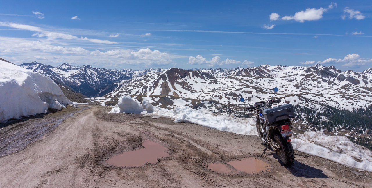
After pics at the summit sign, I rode perhaps a mile more around the bend until the road started turning downwards.  I stopped there for pics:


Then, I saw an offshoot trail heading out to what was called "Oh Point".  Nice place for more snow peak pictures:


Returning to the summit sign area, I started back down the way I came up, heading back towards Lake City.  Some of the views on the way down:


 Somebody really prized solitude to build a cabin this close to the summit

 Back down at mile marker 14, note the signs

Soon after I returned, Martha and I set out to explore some nearby National Forest campgrounds for future reference.  We found that Mill Creek would be suitable in the future.  We rode CR 30 till it split off to go up to Cinnamon Pass on the  right and the remnants of Sherman, an old mining town on the left.

We didn't go very far towards Cinnamon Pass before it got iffy so we turned around and went over to Sherman.  Not much left to explore there except some piles of wood that used to be houses so we didn't really spend much time there.  We returned to the campsite soon after.

Here's a shot of the rocky peaks visible along CR30:


Thursday, June 04, 2020

Camping at Wupperman Campground, Lake City, Colorado

Just a compilation of pics taken from June 1-2 as we found ourselves a nice campsite at the Wupperman Campground run by Lake City, CO....situated along Lake San Cristobal.

It's a really nice location and the fee of $15 a night includes access to water, dumpster, and a tank dump for an additional fee.

It was heavily overcast the first day, Monday, but it was still a beautiful location don't you think?


 One of several deer roaming about the campground sites

Martha and I rode Fiona around the whole of Lake San Cristobal.  Here's a view of our campsite from the other side of the lake:


That evening, Martha spotted a Moose!  It was over 600 feet away or more so my 200 mm telephoto lens proved quite unsuitable for good shots of this magnificent beast.  Here's the best I could do:


 The above should give you an idea of how far away the moose was
from our campsite

The next morning, it was time to get some more scenery shots with the light of a sunny day:


Mid-morning lighting

On Wednesday, Jun 03 we packed up to go back home as there were some medical appointments that had to be done by Martha.  


Halfway to Gunnison though, she had the idea to rent a car and just get herself home.  

Shoot, don't know why we didn't think of that before displacing!

I wasted some time, after dropping off Martha at the car rental place at the Gunnison Airport, and ended up deciding to return to the Wupperman Campground to await Martha's return either late Friday or Saturday of this week.

Fortunately, I was able to claim the same site we had before!

Wednesday, June 03, 2020

Exploring old Mine Sites along Lake County Road 3

Sunday, May 31

In the morning, we headed into Leadville intending to fill up the spare gas can and get some more water as we'd used up the reserve 10 gallons I carry in the URRV.

Before that though, we decided to cruise on up 7th Street to the Matchless Mine to see about touring it, turns out they were closed, opening only Tuesday-Saturday.

No worries though, as we were on Lake County Road 3 at this point we kept on going east of town and would discover many old and apparently abandoned mines, structures and equipment!

This area is definitely a place to come by on Yagi, my TW200 to do more in depth exploration.  We stuck to Ural-able trails and found a rather unique looking wooden structure that was in pretty good shape, considering.

 What I called the front side, with its pool of water providing nice reflections

 The rear of the structure had a cool trestle pathway, where I'm
guessing water was somehow piped to the structure for mining purposes

 A look at the lattice work of logs which formed the base of the
structure and elevated it.

I realized that I could drive Fiona up the trail and pose her at the same location as the above picture....


We kept going on County Road 3, getting a sense of the many old abandoned mines.  We then came upon a hill which I didn't go fast enough at the start and Fiona's clutch got a bit of a workout.  I ended up  having Martha disembark, put Fiona into 2WD and slowly and barely made it to the top of the hill to what looked like a quarry:


Letting Fiona's clutch components cool down for about 15 minutes, I shot the below pic to show you all the mines visible in this particular valley:


As Fiona cooled down, I also noticed the road kept going at a pretty easy looking grade to an interesting tower of sorts, as shown in the picture below:


Martha elected to stay at the quarry location to read her book while I rode Fiona up the trail to see what we could see.  We didn't get very far, hitting snow and not being able to traverse it safely.  It's that time of the year apparently when it comes to high mountain trails!


While I worked to get Fiona turned around, this guy comes up jogging the trail hardly breathing hard!  We exchanged greetings and I returned to fetch Martha so we could start making our way back to town.

 The view before hitting the outskirts of Leadville

We made it to town with no issues, found the RV Dump site run by the County's Water Department.  It's run on the honor system, $5 to dump tanks and $2.50 for water.  Such a deal.  Got five gallons of water and then we headed over to the nearby gas station for 5 gallons of gasoline.

Returning to the RV, we decided to check out the picnic area I'd spotted open on Saturday while wandering about on Yagi.  The skies had gotten pretty overcast and it was a bit windy but we still negotiated our way to the "beach":


We didn't stay long and rode back to the URRV to relax the rest of the afternoon away.  The plan is to displace on Monday towards Lake City, CO and perhaps another attempt at Engineer Pass.....but this time using Yagi, the T-dub!

Monday, June 01, 2020

Uraling with Martha to Freemont Pass and the Clinton Gulch Reservoir

Saturday, May 30

Another good day of camping and Uraling.

Martha and I rode out on Fiona, my '99 Ural Patrol with the Beemer engine soon after a sumptuous breakfast.  We headed towards nearby Leadville with temperatures in the low 50s but bearable with our riding gear and layers underneath.

Gassing up in town, then we headed north on Colorado Highway 91 towards Fremont Pass and the Climax Mine located near there.


We spotted and checked out an exhibit by the Climax Mine Company, showing a series of information signs about the mine and its history.  Pretty new exhibit as the signs didn't show signs of wearing yet from exposure to the sun's rays.  We are, after all, more than two miles up from sea level at this point!

 photo courtesy of Martha

I liked these small posters hung up on the inside of the metal scoop device by which one enters the exhibits area:


 Note the 1950's poster....think it inspired someone who
later had a hand in designing the B2 Stealth Bomber?

 The locomotive engine depicted in the top photo
of the poster above, is the same one that we saw
at the Leadville Train Station yesterday


 Martha by one of the exhibits


 Posing Fiona a bit north of Freemont Pass

From Fremont Pass, we continued north on CO Hwy 91 for a few miles until we got to the south parking lot of the Clinton Gulch Reservoir.  We elected to hike across the dam to the other parking lot and traveled a bit towards the mountains see in the photos below.

The view from about the middle of the dam

 photo courtesy of Martha
Very nice pic by Martha, good use of a foreground anchor object eh?

 Martha on the trail

We didn't go all the way to the end of the reservoir, things got a bit muddy with the melting snow.  We returned to the southern parking lot and got a few more pics:

 My favorite photo of the day.....Martha suggested the angle.


photo courtesy of Martha

Saturday's sunset was pretty good, I almost missed it but Martha noticed the colors in the sky in time for me to rush out to get one good shot before the light faded.