Monday, August 31, 2015

Meeting Ara & Spirit, with bonus Rider: Gina

Most of the motorcycling blogosphere knows of Ara & Spirit.  They've been traveling for more than nine years in a sidecar rig.  Spirit is Ara's companion, a very mellow and friendly Pit Bull.  Ara's rig has been mainly a BMW GS with sidecar attached though he did (for a short stint) drive a URAL sidecar rig as well.

Ara is currently in Colorado and pinged me on Facebook messenger after my last posting went public.  He was in the Gunnison area and was wondering if we could meet.  Of course, it was a yes, once I re-arranged a whole bunch of stuff but in the end it worked out.

I motored out of the Metro Denver area at 6:55 AM and about 4 hours and 30 minutes later was at the campground where Ara was staying.

Mount Princeton as one nears the junction of US285 and US24

They were checking out Crested Butte at the time I arrived in the area (all arranged beforehand) and I took the opportunity to go find and photograph the Curecanti Needle:


There's no spot at the Pioneer Overlook site, located on the North Rim of the Black Canyon area near the Blue Mesa Dam.  I walked to the overlook spots and got these shots of the Curecanti Needle:

 The needle is that triangular rock formation centered above.

A view of part of Black Canyon, looking towards the Blue Mesa Dam

Leaving the Pioneer Overlook area and heading back along the canyon rim, I found a spot that allowed Scarlett to be part of the picture with the needle in the background.

 I climbed up the opposing hillside to get the above angle

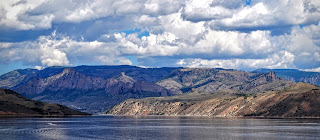
 Zoomed all the way in with the 55mm lens, note the artifact
caused by the camera when showing the tour boat's wake.

This shot taken with the camera mounted on the monopod.

Arriving back at the campsite, I rode towards Ara's reported site and found him and another rider talking by their motorcycles.

Turned out, Ara was also being visited by Gina, another real rider on a Yamaha TW200 on which she's exploring the USA over the next year or so.  She's been on the road four months already and was spending some time with Ara & Spirit before heading towards Zion National Park I think.


Introductions done, I setup camp and took a few pictures of the motorcycles.  All three of us had some very interesting conversations during this time, and around 4:30PM Ara made us a dinner of Curry Chicken over rice.  Yummy.  

After dinner, it was time to take Spirit for a little walk.  All four of us walked slowly to the nearby shore of the Blue Mesa Reservoir/Lake.  Engaging and flowing conversations continued throughout as we waited for perhaps a nice sunset.


 Gina, Spirit and Ara

 A nearby rocky mesa 


Centered, you can see part of the Dillon Rock formations.

Clouds blocked the sun as it set alas, so no pictures of a nice sunset.  I was shown by Gina, a really awesome sunset picture of the evening before though.  It was a beautiful shot, especially since she shot it just using her camera phone.

Evening progressed and we talked until we lost all light, though we did get to enjoy a sporadic display of lightning bolts to the west as things got progressively darker.  The wind picked up and after a failed attempt on my part to capture the golden almost full moon as it rose in the east, we packed it up for the night.

In the morning, I packed up my tent as Gina also prepared to depart for points north and west.  I said my goodbyes to both Ara and Gina, and petted Spirit one last time before heading back home.


Had a great if short visit with Ara, Gina and Spirit.  Great company and full of good stories of their times on the road.  

On the way home, in spite of some "incidents" with two separate idiot cagers ( both towing large loads and generally behaving like a-holes), I did get some pictures of part of the Collegiate Peaks as I motored on US/24US285 homewards.

 I believe this is Antero Peak
(note visibility of headlight)


Scarlett performed in an outstanding manner.  Recently, after some research sparked by comments made by RichardM as to RPMs he was using on his URAL while riding home; and checking with the Ural dealer and the mothership at IMWA, I rode the rig a bit harder than usual while in 3rd gear and on inclines.

I cruised at 60-65 mph on the flat straightaways and while in third was able to hold at least 50 and sometimes close to 55 while on the steep hills along the route!  

Heck, the RPMs never crested 5000 RPM, in third gear, as I managed to pass not only several cars and trucks but also four Harley-Davidsons while on the way to the summit of Monarch Pass on US 50!  Of course, the harleys were in a group and the first harley was towing a trailer but still!

As I passed the total of five cars during this trip, I remember thinking: "Dude, you got passed by a URAL, on a hill!"

Before all the research, I had limited my rigs to about 4200-4300 RPM and had been content to just motor along at about 45 mph on the hills.  These engines apparently prefer to be in the higher revs, not the lower revs so it's all good.

Round trip mileage: (716 Km or almost 430 miles)

Thursday, August 27, 2015

Sunset Clouds and a Colorado Sunrise

Sunset Clouds

Not much of a sunset yesterday evening, but it was not bad in terms of temperatures, probably in the low 80's and a slight breeze.

In a sign which I am hopeful means the fires out west are being brought under control, the skies were not as hazy and one could even discern the profile of Mount Evans along the Front Range:


The sun would prove not visible as it neared the horizon, so I had to content myself with how it painted the clouds overhead:


As 8:00 PM approached, I went to a local community pool where my youngest son, Miles, has a part-time job as a pool boy.

Scarlett in the pool parking lot
(that's the low beam)


I think I like the angle better on the first shot of the brick tower next to the pool.  What do you think?

Sunrise.

Today I got out of bed earlier than usual (been pretty lazy lately) and managed to get out of the house before Sunrise which was at 6:22 AM.  I lost some time as I didn't have a specific spot picked out as I do with my Sunset picture rides.

Instead, I looked to the brightening eastern horizon and mentally picked a spot solely based on cloud position and where the light from the sun was beginning to paint them a yellowish glow.

I ended up a little north of Quincy Road, a few miles east of its junction with Gun Club Road.  This portion of the road is bordered by deeply sloping terrain, allowing me to be "below" the rig for the shots.

 I barely got the rig in place before the sun started peeking from
below the eastern horizon


On the way home, a rainbow shone in spite of the rising
sun's effort to quench it with its brighter light.

Not a bad way to start the day, eh?

Wednesday, August 26, 2015

Guest Blogger: Darrell S. Rides part of the COBDR

Guest Blogger: Darrell S and his lovely wife Piper

Back in the first half of August, a fellow Uralista and friend of mine, Darrell S. and his lovely wife Piper rode their 2014 URAL Patrol Sidecar Rig along parts of the COBDR (Colorado Backroads Discovery Route).   Here is their report:

Buena Vista to Lake City.

Not a challenging section, but long: 212 Kms total.

Passes crossed (in order)
Cottonwood Pass
Cumberland Pass
Waunita Pass
Los Pinos Pass
Cathedral Pass
Slumgullion Pass

I stopped in Pitkin and put a gallon of gas in my tank because I wasn't sure exactly how long this section was.  I only put a gallon in because they didn't have 91 octane.  Turns out I didn't need it.  Could've made it on one tank of gas (or at least one tank along with the Kolpin reserve I had).

The most challenging section was a small section off of county road 14PP.  There were a couple of hills I wasn't prepared for and before I knew how steep they were, the rig didn't have enough umph or momentum to make it up.  I just turned around and tried each a second time and had no problem making it up them.  Not that they were extremely steep, but one didn't realize how they were until you were upon them......

Basically, a long hot day in the saddle.  Left Buena Vista at 9:30am, arrived Lake City at 4pm.

Lake City to Telluride

This is a very short section if you can take the main route laid out on the map.  64 miles total.  It goes over the following passes:

Cinnamon Pass
California Pass
Hurricane Pass
Corkscrew Pass
Red Mountain Pass
Ophir Pass

We left out of Lake City and had high hopes of being able to complete this section on a Ural.

We motored toward the top of Cinnamon Pass with no troubles......until we came to a switchback that had a large rock outcropping on the road just on the uphill side of the switchback.  I just couldn't get enough umph
around the switch back to make it up over the rock outcropping.

Piper got out of the sidecar and I tried one last time.  I made it 3/4 of the way onto the rock and my rear tire got caught in a shallow hole in the rock.  I was just about to use my winch to get over the remaining portion when a vehicle coming down the mountain stopped to help.  A man and his son helped lift up and push the rear of the bike as I tried my best to burn up the clutch.......but it worked!

I was up and over the rocks.  The rest of the ride to the top of Cinnamon Pass was uneventful.  We crested the top and it was a steep ride down the other side to Animas Forks.

Looking back towards Cinammon Pass from Animas Forks.

We rested a little in Animas Forks and then started the trail up to California Pass.

Animas Forks Gold Mine

The road up to California Pass

This is a very rocky/bumpy trail for the most part.  We had no trouble navigating the trail, but had to keep our speed up.  We hit one section were someone coming down didn't give us the right-of-way and I had to turn around and find a level spot to get going again.

I'm not exactly sure how far up we made it on this road, but I believe we were within 1/2 mile of the pass.  We hit a right turn switch back that I just couldn't make it past.  It was a very tight right turn and a very steep incline just after the switch back. The third time I tried I made it at least half way up the steep incline and realized I wasn't going to make it so I braked.

I didn't want to back down, so I slowly started turning the bike as I coasted backwards to have the sidecar wheel downhill.  I got to the point where I was completely sideways on this section and the whole bike just started sliding sideways down the steep part of the road.....Piper wasn't happy and was almost ready to jump out of the sidecar.  I finally righted the ship and got going downhill the right way.

A factor that I failed to realize about this pass was that it is the highest pass on the COBDR at 12930'.  The
altitude was also robbing the Ural of what little power it has.

We stopped to discuss the situation and not knowing what the other passes were like, we were too concerned that we might get in an area where we couldn't make it out of.  So the decision was made to turn around and take the road back down to Animas Forks and then the road down into Silverton.

Road from Animas Forks to Silverton

From Silverton, we took 550 up to the turnoff to Ophir Pass.

Ophir Pass looking west

Ophir Pass is very Uralable and we had no problems climbing up the pass.  Going down the other side is
another story.  For the first mile, it is very loose rock and a sheer drop off on the side.  Make sure you have good brakes and go very slow.  I mainly used by rear/sidecar brake because it left me the ability to steer with the front wheel.  If you lock up your front wheel in this section it could get hairy real quick.

Summit sign at Ophir Pass

Ophir Pass Western Road

Ophir Pass, waiting for traffic to clear the way

We made it down the west side of Ophir Pass and on into Telluride.  One note on Ophir Pass.  It can be done West to East, but going up the west side, once you break out of the trees and get to the all rock section you need to wait to make sure no other vehicles are coming down when you start your run across this section.

A Ural can make it up if it doesn't have to stop.  There aren't many areas for someone to pull off to the side to let you pass and if you stop then you are in trouble.  So as we were making it down, we made sure no one was coming up, because didn't want to have to try and get out of their way.

So the only passes we crossed today were Cinammon and Ophir.

We left Lake City at 9:00am and arrived in Telluride at 2:00pm.

Telluride to Dolores to Four Corners.

A very easy section of the COBDR with some of the best scenery.

Wilson Mesa Ranch Area

Road 618 Southwest of Telluride

Road 49G Overlook

Not a challenging section by any means.  Easily traversed dirt roads.  It did rain quite a bit the night before and there were sections of road 618 that were muddy and slick.  After making it through this part, we stopped on a section of 611 to take a break.

We could hear the faint sounds of motorcycles coming up the trail so we waited to see who it was.  They stopped to talk a little bit.  Two Canadians on BMW's just starting out on the COBDR.  We had a nice chat.  The one asked us about mud...he seem quite concerned about it.  They warned us about a mud hole just a little ways down the trail and we were both off in our different directions.

It didn't take long to figure out why the one Canadian was concerned about mud.  We must have found at least 5 locations where his bike fell over in minor muddy spots.  Not to let him outdo us, we came upon the mud hole they told us about and it didn't look too concerning.

I took a line and started into it.........the part that the sidecar tire went into was way deeper than I had anticipated and the sidecar tire went down into and it swung the whole bike around to where the front tire was in the same hole as the sidecar tire.

Well my testosterone got the better of me.  I put it in two-wheel drive and hit the gas.  The front wheel came up out of the pit, but now both drive wheels were stuck in it.  I couldn't go forward and I couldn't go backwards.

Piper tells me to stop and lets look at the situation.  I finally listened to her and got off the bike.  She took a pic and proclaimed "stuck Ural!".


It really wasn't that hard to get out.  I physically  lifted up the whole back of the bike and Piper pushed to where the back tire was out of the mud but the front tire was back into it.  I then went around the front and picked up the front end of the bike while Piper pushed backwards and we have the front tire out of the mud.  I then got back on the bike without Piper in the sidecar and drove right out of the hole.......

Back on the trail, there are a couple of interesting FS roads before you hit Dolores (FS C and FC 257).  Nothing too difficult but better than motoring along FS 527.

The ride from Dolores to Four Corners is all paved, hot, and long.  The actual Four Corners monument was
underwhelming.

Four Corners

Anyhow, we accomplished it.  We completed the COBDR with only one minor diversion.

Monday, August 24, 2015

Shots from Higher Angles

There have been times, in some of my rides, where I would have parked next to the edge of the road and I would have tried to capture a view of the heights below, but usually unsuccessfully.

Sure, sometimes, I'd have a climbable hillside on the other side of the road where I could gain height to hopefully see the valley bottom below, but again, it usually didn't work out.

I needed more height to shoot from....

Today, I rode out to Castlewood Canyon Park, the nearest place where one can briefly park one's vehicle alongside the road and peer down to where a dam used to be.  It's not a very scary height though rolling down off the edge would not be a good thing for any vehicle.

According to Wikipedia, the Castlewood Canyon Dam burst in 1933, sending a 15 foot wave of water all the way into downtown Denver!  LINK

So, here's some shots of the remains of the dam, from a higher angle than normal.  No climbing of nearby hillsides involved:


Here's shots from the last time I was here for pictures with Valencia, my 2011 Patrol.  I believe I had climbed the small hillside opposite her for the angle:


Here's a shot of Brigitta, my '87 R80 Airhead Beemer, from ground level:


Today's photos were achieved not by climbing a nearby hillside or by the use of airborne equipment but by the use of a fully extended monopod.  It's a bit of an effort to hold it steady, but combined with the remote view/activation app on my iphone I can take shots without being near the shutter button.

The app let's you see what the camera sees, you press the screen where you want the focus to be (in this case, the rig), wait till the marker turns green and click the shutter button on the app.  Done!

I must have looked quite the sight, to the cagers that drove by as I shot pictures.  Some guy in full motorcycling gear and helmet, holding a six foot tall pole with a camera attached on the top!

I see potential benefits to using the monopod when traveling on mountainside roads, to give you an appreciation of the heights above which the rig is parked.