Sunday, July 12, 2020

Uraling to Boreas Pass

Friday, July 10

While eating breakfast, I spotted what I think is a prairie dog though much smaller than the ones you can spot on empty grounds on the Front Range.  It was sniffing one of the wire connectors belonging to my solar panels.  Luckily, it didn't find it appetizing.


Today's destination is the pass which crosses near the leftmost mountain in the picture below, Boreas Mountain:

Telephoto view from the campsite

Rode out mid-morning towards the US 285 highway, intending to go south on it towards the small town of Como and the southern end of Boreas Pass Road.

First though, I waited a while for a break in the southbound traffic, in order to safely make a left turn onto the southbound lane.  There were a lot of RVs, pickup trucks hauling trailers with boats, ATVs and campers and just plain cars all stacked up in long lines of traffic.   It could be easily described as "a rolling shit show of RVs and Boats".

They all seemed frantic to flee the Front Range, not that I blame them.  Northbound traffic on the other hand, was minimal.

Finally catching a big enough gap in traffic, I got on the southbound lane and rode down to Fairplay (16 miles away) to get gas for Fiona as I'd failed to fill up her tank while at the camper.

Driving back six miles to the exit for Como, it was bumpy riding on the dirt road up and to the summit.  More cars than I expected, some motorcycles (perhaps 5 total) and bicyclists of course rode to and from the pass; some kicking up huge plumes of dust as they were moving way too fast.  I especially despised the ones that came around blind curves at high speed, hogging the middle of the narrow road.....lovely.

North of the summit sign, there's this one spot that I like posing my motorcycles at with the mountain peaks in the background.  As I approached it from the south, the place was a veritable zoo of cagers.  All the stopping spots were taken and a mass of people wandered up and down that stretch of road taking selfies and group pictures.

Too crowded, so I kept going.  Miles later, I saw a nice view of the ski trails of Breckenridge; which is the town on the northern end of Boreas Pass Road.

 The lake is called Goose Pasture Tarn
and part of the town of Blue River


It was from the above spot that I saw a curious looking site:


Here's what the site looks like using Google's satellite imagery mapping tool:


Weird huh?  I'm guessing perhaps it's a specialized shooting range?  What do you think?

Having no interest in going further closer to Breckenridge and its crowds, I turned Fiona around at this point and headed back towards the preferred views spot.


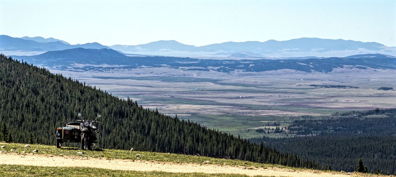
I was pleased to find the preferred viewing spot free of any cagers or other traffic:


Continuing on for about a mile, I stopped at the pass summit for the requisite picture of the pass sign.  I've yet to explore the buildings that are there, part of the narrow gauge railroad that existed and created Boreas Pass Road I believe.  It was very, to my mind, crowded with folks.


It was past noon at this point and I'd had it with the crowds, minimal as they were, and headed on back to the campsite.  Ah, blessed solitude once more.

More campers had shown up, I counted 14 occupied sites, some with more than one camper or tents set up.  There's even a group of about 4 cars/trucks with small campers and tents now set up across Rock Creek Hills Road; across from my camp, perhaps 1/4 mile away so not too bad.

The after sunset light display wasn't too shabby:


Friday, July 10, 2020

Camera troubles and displacing to a nearby site

Thursday, Jul 9

Went riding on Yagi, my '06 TW200 to further explore a  set of trails located near the southern end of the dispersed camping area within the Pike National Forest within which I'm boondocking.

Nice set of trails, with further stuff to explore at the end of the main trail within but I ran into technical problems with my camera.

I had been taking pictures of possible future campsites when I got the "camera error turn off power" message on the LED screen.  Dammit.  I tried removing the battery, waiting a few and then reinserting the battery but no luck, same error.

I didn't have good signal where I was at so I packed things up and headed back to camp where I did have a good signal.

I noticed, back in the URRV, that the shutter screen was down when I took off the lens.  Hmmmm.  Some googling later, it turns out to be a pretty common problem.  One suggestion before I tried a system reset was to shake/tap on the camera body to get the shutter to release from whatever obstruction was keeping it from moving.

I tapped the camera from the bottom and top, nothing.  But then when I re-inserted the battery and turned on power, the shutter screen retracted!  Yay.  I shot many test shots and everything seems to be working fine.  I guess all the dusty conditions I ride in at times finally took their toll?  

Must come up with way to shield camera from dust I guess.  Closing up the zippers on the tank bag would surely help eh?  Such a PITA sometimes though.  Oh well.

I was relaxing outside in the shade of the URRV's awning in the afternoon when I heard truck engines coming nearer.  I looked around and saw not one but two trucks with travel trailers in tow, parked near my campsite and looking like they wanted to settle in!  WTF.

Given, my campsite was at the eastern end of a rather wide open field suitable for group camping but dammit!  So I kept an eye on them and after some discussion, I guess they decided to leave me alone and headed off elsewhere.  Good riddance I thought but after a call with Martha decided to displace to a different site.  The weekend campers were coming you see.....

I'd seen the site empty during my morning riding so after confirming it still was with a short ride with Yagi; I hurriedly broke camp and claimed the smaller site.  Its clearly a one camper site but not cramped.  It's even farther from the main road (Rock Creek Hills Road aka CR39) and I think has a better view of the mountains to the west.


 Shot from access road which parallels the area's main road
(FR392A)


 Some nice trees for shade

Pretty close to the view I had before, but more of 
Mount Boreas is visible; its the rightmost peak.


Did some light riding on Yagi in the afternoon to check out my neighbors.  The place is indeed starting to fill up.  Still, breathing space remains for now.

Had a visitor come by, got as close as perhaps 50 ft from the URRV.  He munched away at the grass nearby, mauled a tiny pine tree using it as a scratching post and finally meandered away.  


Then, the Golden Hour started:


A clear skies sunset:


Thursday, July 09, 2020

Uraling to summit of Georgia Pass

Wednesday, July 7

It would be another nice sunny day, with clouds forming in the afternoon, and high temperatures in the mid-70s!

In other words, great riding conditions for summer!

My view as I ate breakfast:


I rode out on Fiona, my '99 Ural Patrol and decided to a loop, headed out going north on the main trail traversing this dispersed camping area I'm currently boondocking on and soon was back on FR/CR 56 aka Lost Park Road headed towards the US 285 Slab:

 Part of the Continental Divide visible from the east side
of South Park Valley.  The right-most peak is Mt Guyot and
I would end up near its base!

First, I headed up towards the summit of Kenosha Pass which is reached using US 285, here's a view of South Park behind Fiona.  I am boondocking in the wooded area on the left, which is the northern portion of the Pike National Forest.


View of the peaks as one heads back down from Kenosha Pass on US285:


I rode to the small "town" of Jefferson and headed west on CR37, following the route towards Georgia Pass.

 Getting Closer

The road was dirt all the way to the top, very Uralable and with only a few really bumpy spots due to exposed rocks.  The slope going up wasn't too steep and Fiona didn't experience any issues.  I got to the top and got the requisite pic of the summit sign:

 That's Mount Guyot in the background


The summit area is unremarkable, with two trails evident.  One headed towards the Colorado Trail and Glacier Ridge and the other down from the pass and I'm told eventually reaching Breckenridge.  Both trails were described as tough and gnarly by a local who UDF'ed me while I took pictures.

Needless to say, I would be retracing my way back down the mountain!

 View of South Park from summit of Georgia Pass

Following the first UDF session, a group of three dualsport riders showed up and one of them UDF'ed me some more.  When the UDF finally ended, I saddled up and rode back the way I came.

One last view of Mount Guyot 

I returned to my campsite, did some small chores but generally relaxed.  Even managed to take a good nap though I think it's going to have to be a rare thing.  I had trouble falling asleep that night!

I did some recce riding with Yagi, my '06 TW200, checking out the campsites along the northern half of the main trail.  The place is starting to fill up I think, saw more tents and campers.  I did meander down FR 131, 821 and 132.  Nice areas to ride in but the only one with possible future campsites was FR131 and it would be a bit tricky to get Uma, the URRV in but doable I think.  

Saw nice sites along FR821 but the URRV wouldn't make it there due to ruts and road conditions.

Tuesday, July 07, 2020

Boondocking in the Pike National Forest

Near Jefferson, Colorado.

In an effort to escape the stifling heat on the Colorado Front Range, I drove out of the cesspool that is the Metro Denver area and escaped into higher elevations.

Didn't go too far, just shy of the small town of Jefferson, CO and then took Lost Park Road aka County Road 56 to County Road 39 and into the Pike National Forest.  Note: Next time, I'll take the paved road south of Jefferson to get to CR 39, CR56 is heavily washboarded!

I'd stayed in this area before while camping with Martha and other times by myself, I like it, not too popular but close to Boreas Pass Road, the towns of Fairplay and Jefferson and with views of part of the Continental Divide Mountains!

Found a nice big spot with good cell signal.


As you can see, it was partly cloudy but it would be pretty sunny the rest of the day when the clouds permitted it.  Temperatures were in the mid 70s, quite nice while I believe the temperatures in Metro Denver were in the high 80s if not low 90s!

 Some Thirteener Peaks to the west

I did some light riding along CR39, just to get a feel for how many campers were in the area.  I saw 8 other occupied campsites, a mix of tents, truck campers and travel trailers.   As for motorhomes, it was Uma and a Class A.

Mostly I just enjoyed the warm sunshine, cool breezes and the lack of people.  Plenty of flies but not too bad.

Tonight's sunset wasn't too bad:


I hope to ride over Boreas Pass sometime in the next few days, perhaps explore some of the trails within the Pike National Forest with Yagi, my TW200.