Thursday, February 27, 2025

Boondocking in the Gila National Forest, near Lordsburg, NM

Wednesday, February 26

A short driving day today, I wanted to check out the Gila National Forest area north of Lordsburg along US90.  Not great shakes for scenery but its a nice area.

iOverlander showed a spot for camping and that's where I ended up, finally picking a spot big enough for the VRRV and trailer.  Most of the spots are smaller, more suitable for van campers and such.  Still, very secluded and quiet for the most part.


There's only one other "camper" out here in the area with me, about .5 miles away.  He's a car camper from Minnesota.  Not too sketchy looking, but I did wonder what the heck he was doing here over the next couple of days.

This particular camping area reminded me one should pull in one's mirrors when passing through narrow portions of the trail when there's thick bushes alongside the trail.  One of the small auxiliary mirrors got ripped off, but I repaired it easily enough.

I did have one bar of cell signal, enough for texting but really not for surfing.  I powered up Starlink a couple of times.

Thursday, February 27

After a very quiet night and no further campers showing up, I spent the morning doing minor chores and repairs while windy conditions prevailed.

Around 2 PM or so, I rode Yagi, my TW200 to check out the Tyrone Mine further north along US90.

Along the way:

I think if I was McComas, I'd call it more than an incident.

I'd hoped to be able to find an overlook to see into the mine but no luck, so just views of the huge amounts of tailings dug up in search of ore.


eye catching pattern 


US 90 crossed the Continental Divide and there were two spots with trailheads to the CDT or Continental Divide Trail near my campsite:


As I rode south on US90, I checked out likely locations for campsite for future use.  Found several along Gold Gulch Road and Kings Canyon Road.  I marked the spots in my personal google maps for possible future use.  If I had been planning on staying longer in the area, I'd have displaced to a couple of the sites!

Tomorrow I displace to Elephant Butte/Truth or Consequences.  I think I'll be using the route through the mountains instead of retracing my way back to the I-10 Interstate.  We'll see.


Wednesday, February 26, 2025

Seeking Historic Fort Grant

Monday, February 24

Scarlett and I rode along AZ Hwy 266 towards what Google Maps called Fort Grant AZ State Prison and the village of Bonita.

The road is paved and as one approaches and cuts through a low range of rocky hills.  Nice rock piles to be seen which remind one of minor versions of the large rock piles at the Indian Bread BLM Recreation Area.

I'd hopes there'd be a section at the state prison set aside to showcase the historic beginnings of Fort Grant.  I found nothing of the sort, though I didn't venture too far past the visitor parking lot either.

At the isolated remnants of the village of Bonita, the only "historic" thing I found and it probably not that old, was the old general store:


Do you see Scarlett's reflection?


Retracing my route, I paused to take pictures towards the prison itself.  A large, square and white object atop the mountain had drawn my eye:


Mt. Graham National Observatory 
"World's largest optical telescope"

Ft Grant AZ State Prison

Riding along Highway 266, there's several spots that are apparently AZ Trust State Lands, some accessible for camping rigs.

I explored one such area, drawn by the remnants of a wind operated water well:


I got back to camp with no issues under sunny skies and warm temperatures.  You do feel a slight chill while riding at speed but it was not bad at all.

Sunset was not bad:

Sunday, February 23, 2025

An Almost Relaxing Weekend

Saturday, February 22

No riding, just more relaxing at camp in the gazebo, listening to an audio book and enjoying the solitude.  The expected uptick in traffic presented itself in the form of about 3 ATVs, about 4 pickup trucks and one tow behind pop up camper cruising by on Tanque Road.

There were a couple of yahoos wandering about in a big circle almost 1/4 mile around my camp.  They were hunters apparently as I heard a shotgun go off a couple of time.  They left by noon and good riddance, hunting near camping rigs, morons.

Otherwise, it was a nice warm day, gentle breezes.  

Sunday, February 23

The morning started off in an annoying manner.  I woke, raised the blinds facing the road and here's what I saw:


Over the next few hours, watched them take their dog out and let it poop around the campsite.  Saw one of them take a roll of TP but no shovel into the bushes across the road, you can imagine what was left behind.  

Shitbirds must have snuck in after I went to bed at 9PM last night.  I didn't hear them come in.  They didn't leave till almost 11AM but at least they did finally left, leaving me alone once again.

The site, which is next to the road, is now occupied:

The rest of the morning and all the afternoon was spent regaining my Chi or Qi.  

Had an unexpected visitor stop by for a bit:


I did not expect to see a dragonfly in the middle of a desert area!  

By 4PM, my Qi had recovered enough that I thought I'd ride towards the eastern end of the San Simon River Valley to get a shot of Javelina Peak.

It's roughly ten miles of sandy road with lots of wash boarded sections, but Scarlett did just fine.

Found a good spot to pose her with Javelina Peak in the background.  From this spot, it was still 8 more miles to the Hot Well Dunes Recreation Area where I've camped several times before.


Google Maps had shown there was a rail line crossing the valley north to south, I'd not remembered seeing on in previous visits.  Yep, there is still a rail line, no idea if its active or not:


Riding back was a bit hazardous, not only do you have to contend with the sand and wash board conditions, but the sun is in your eyes!  Oh well.

Made it back to camp with no issues.  Had a nice phone chat from a college buddy who I've not talked to in a long time.  It was good catching up with him.

In a day or three, it'll be time to move closer to Colorado by way of New Mexico.

Friday, February 21, 2025

Uraling the Swift Trail Scenic Byway

Wednesday, February 19

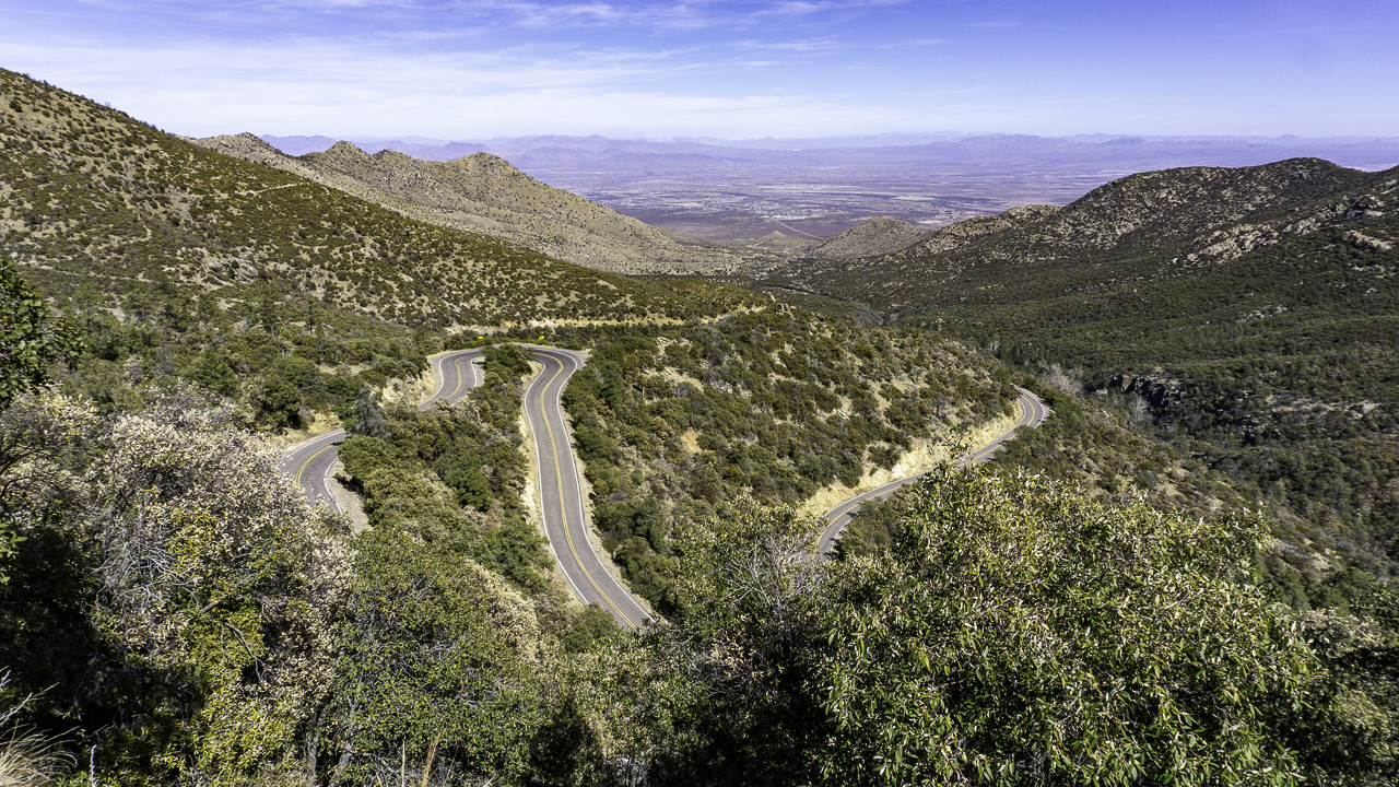
I rode out on Scarlett, my 2014 Ural Patrol, to check out the views from the heights of the nearby Swift Trail Scenic Byway aka AZ Hwy 366, a bit SW from the city of Safford, AZ.  More info on this byway:  LINK

It's a paved and sometimes very twisty road steadily climbing up the sides of Mount Graham, though the road is closed at this time near the top, before one reaches the antenna complex on Heliograph Peak.  The closure is seasonal, and I was too early.

I went from 3000+ feet at the campsite to over 9000 feet in altitude.  It was rather cool up there, and I can see why folks had built some "summer houses" up there when it gets hot down in the valley during summer.  I even saw remnants of snow in the shady areas of the road.

Lots of hairpin turns on this road

Close to the top of Mt Graham and
my turnaround point

Views as I descended back down the byway:


It was roughly a 60 mile round trip for Scarlett, and I returned to the campsite for a restful afternoon.

Thursday, February 20

Woke to a carpet of clouds to the south which produced a dappled cloud look on the mountains to the west.


Spent the day doing not much of anything.  Listening to a book in the gazebo, enjoying the warmth of the sun.

Sunset was not bad, I was too lazy to actually go outside to take pictures, these are the ones I took from the VRRV's window: