Monday, February 14, 2022

How I Spent Super Bowl Sunday and the importance of good connections.

 Sunday, February 13

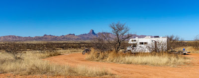
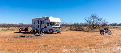
I woke this morning, at site 74, feeling rather cold.

Not surprisingly, it was 24°F (-4.4°C) outside and barely 35°F (1.6°C) inside the VRRV!  The forecast had been for a low of just 34°F (1.1°C) so I'd gone to bed without engaging the propane heater!

I checked the weather app and the surrounding area was reporting low to mid 30s!

It was then I remembered the fact that cold settles to the lowest point.  I'd forgotten that, and had camped next to an old stream bed which of course makes it the low point for the surrounding terrain of the campsite!  Doh.

I decided to do a hasty displacement to site 73 before someone else occupied it. (It is apparently popular with day users and their trailered ATVs)

Got everything packed up but couldn't get Scarlett started!  To make matters worse, the starter decided that today was the day it would quit even working intermittently.  The starter had been going downhill over the last few weeks and I'd been meaning to unmount it to clean it.  I was now paying the price.  

I couldn't get Scarlett started through the kick starter either!  I'm thinking it was just too cold, and apparently fuel-injected engines don't start as easy in the cold as do carbureted engines.  (This was a comment made by RichardM when I later discussed things with him).

So, I was burning daylight, and decided to leave the rig and take everything else over to the new site.  It's good that I did because as soon as I put it into park within site 73, a truck came by dragging a trailer with two ATVs on it!  The driver gave me a long look as he was forced to go find somewhere else.  Hah!

Leaving the rig, I walked the two miles back to Site 74, the exercise serving to warm me up.  More kick starting and attempts to get the starter to work via wishful thinking failed.  Then I decided to try and bump start the rig by pushing her up to speed in a very slight downhill grade just off the entrance to the campsite.

Well, it took four attempts, each time with me dragging the rig back up to the top of the hill, before the engine caught!  Once started, I rode her the two miles to site 73 and shut her down. (Definitely got my cardio workout this morning!)

Got camp set up and ate breakfast, then tackled the cleaning of the starter.


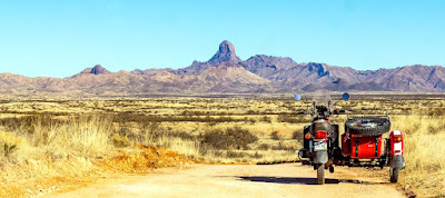
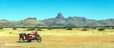
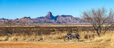
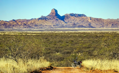
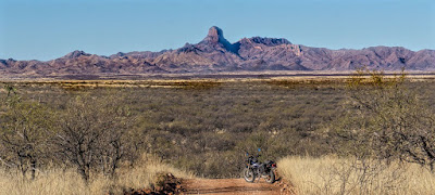
I like this view of Baboquivari Peak better

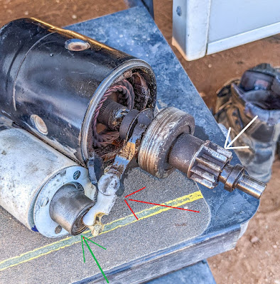
Unmounting the starter wasn't a big deal, taking it apart was a bit dicey the first time but no real issues.  As you can see, it was a bit dirty.


After I cleaned things up, I mounted the starter back up and got nothing.  Just spinning noise from the starter motor.  Dammit.  Took it back off, cleaned some more and then realized I'd installed the white plastic lever above upside down. (red arrow above)

So, got it back together, and hooked up the starter to the VRRV's coach battery and tested it.  I could see the Bendix Pinion Gear  (white arrow above) spinning up to the top as designed before dropping back down.  Yay I thought.

Got it mounted again.  It rattled the first time, like when the pinion gear wasn't going up to engage the flywheel's teeth.  The second attempt resulted in engagement and start!  Yay, I again thought.

Buttoned things up, went to test and got nothing, just the death rattle.  Dammit.

Did more research, thought some more, and saw that sometimes a weak battery can cause the solenoid (green arrow above) to not push strongly enough on the plastic lever which pushes the Bendix Pinion gear assembly up to meet the flywheel's teeth.  The voltmeter I put on the battery reported 11.89 volts so it was dead from all the previous cranking attempts.

So, a couple of hours later, I had recharged the battery via the small generator I carry with the VRRV and damn if it didn't start working more reliably!  There's a pattern emerging (I went for a test ride with multiple stops), first I hear the starter motor spinning but no engagement.  Second button push results in a clean start!  It did this each of the times I shut it off then started it back up again after a short interval.  Weird.  But, it's enough for me to declare victory and see how things go.

So, that's how I spent Super Bowl Sunday.  I will say, the new site is much nicer in terms of views eh?  I hope, it being at a higher elevation than site 74, that I'll wake to expected low temperature not something almost 10 degrees colder!

Monday, February 14

Happy V.D.!  Valentine's Day that is.

Another great warm day here in southern Arizona, the temperature got up to 78°F (25.5°C) and it felt pretty good.  

I went riding on Scarlett, just to check out the roads to the west and north of my present campsite.  Found a couple of campsites, noted them in google maps for future reference.

The towering presence that is Baboquivari Peak made itself known as I rode along:


Here's shots of the couple of campsites I found on state land (possibly private land which has granted public access, kind of like parts of the Santa Margarita Ranch where I camped last week).


Before I took the above shot, I encountered an issue with Scarlett when I went to start her up.  No power, nothing, nada, no lights, no fuel pump....dammit.

I of course went down the wrong rabbit hole, thinking it was a problem with the ignition lock assembly.  It's been giving me issues for quite a while now, I really should get around to installing the replacement unit I bought oh so long ago.  

I had removed the seat, thinking perhaps to check the three relays underneath when I realized I left the multimeter in the VRRV!  Then I thought to hotwire the rig to get it going but attaching a wire with alligator clips on both ends to the battery and what I thought was the ignition wire at the lock failed.  Hmmm.

I called up RichardM, and he patiently (as always) walked me through the troubleshooting process. He keyed on the fact I wasn't getting a spark when using the alligator clipped lead wire....he had me check the cables at the battery.

I found both connected as expected but a tad loose, especially the negative side.  Hmmm.  I tightened them both down and damn if that didn't restore power.  Doesn't take much looseness apparently!  Yay.  I thanked RichardM and proceeded to button up the rig.

Got back to the VRRV and spent the rest of the afternoon, resting and reading....with some minor chores thrown in.

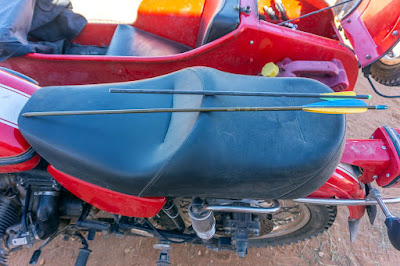
Here's a pic of the two arrows I found at each of the two campsites that I recorded on google maps.  Weird that people left them in the fire circles eh?


Towards late afternoon, I packed all the outside items to include both motorcycles.  The plan is to move towards Why, AZ tomorrow.  Its forecast to be a windy day so a good time to move, especially since a little rain is expected for the BANWR on Wednesday.

14 nights here in the BANWR area, and my onboard fresh water tank lasted me till yesterday!  Not bad.
Saturday, February 12, 2022

Campsite Exploration leads to a short Camp Displacement

 Friday, February 11

The day's main activity was exploring campsites along the High Gates Road.  This is the primary access road to a large portion of the 80+ designated campsites in the BANWR.

I found a couple of nice ones for possible future use.  Then I ran into a couple of volunteers for the Dept of US Fish and Wildlife, who were checking campsites and cleaning up as required.  They stopped to talk and we chatted about the campgrounds.  They even had a map of the area which only cost $5; and would prove a boon in terms of finding my way around the BANWR and surrounding lands.

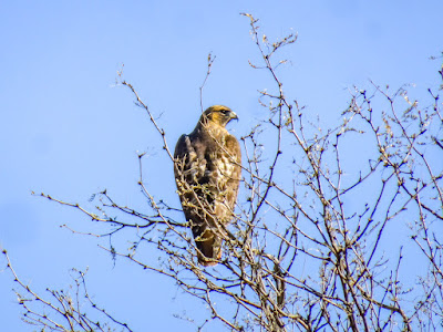
The only pics I took were of a Hawk? or perhaps young Eagle?  Not sure, it was just sitting up in a tree, watching me watching him.  


The rest of the day was spent back at the campsite, a short nap was involved this time and some watching of a movie on Paramount+.

Saturday, February 12

I decided to go check out site #73, which the US Fish and Wildlife volunteers had mentioned as being a pretty nice site, away from the main groupings of sites but still inside the BANWR boundaries.

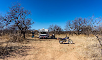
I drove Scarlett, my 2014 Ural Patrol Sidecar Rig the 8 miles or so to the main entrance for the BANWR and across the highway was FR201.  I took FR201 a short distance on a nicely smooth dirt road and found site #73, but it was occupied by day users with their truck pulling a trailer with an ATV on top.  Oh well.

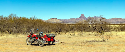
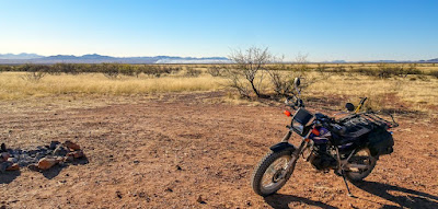
It was indeed a nice site though, I bit exposed to the weather but nice views:


So I continued on, to check out Site #74 which was two miles away further south along FR203.  It turned out to be such a nicely secluded site that I turned right around and headed back to the campsite to pack up and move!

I'd been toying with the idea, you see, of displacing on Sunday either to a site along FR227 (High Gates Road) or even moving on to the Organ Pipe Cactus National Monument.  

Now, I can complete the full two weeks here in the BANWR area and still get in a different camping venue.


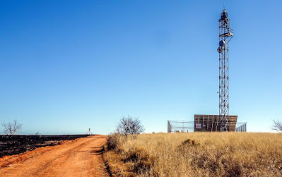
One hill to the south, perhaps a 1/4 mile from the campsite, is this tall tower which I believe is operated by the Border Patrol.


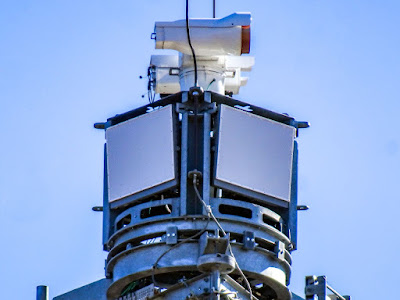
Here's a closeup of what I believe are cameras of some sort atop the tower, this angle is from the direction of my campsite or north:


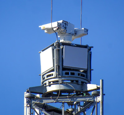
Here's a view of the southern facing portion of the tower's equipment:


Interestingly, the cameras appeared to be oriented west by northwest....not south.

After setting up camp and resting a bit, I rode out on Yagi, my TW200 Dual Sport to explore FR 203 and the FR205 which eventually dumps you between Mile Marker 2 and 1 on AZ Highway 286.  It's a very smooth dirt road ad the last couple of miles are a bit twisty, making things fun as well.

After checking out the tail end of what I believe is FR281 from FR207 I decided to turn around (it got pretty technical) and retraced my way back to FR205/203.  

Sony HX80

Sony A5000

I rode all the way back to Site 73 to see the day users packing up their ATV.  So I guess the site is available, but I think I'll be staying where I'm at.

More exploration of trails and campsites to come in the next day or so.

Thursday, February 10, 2022

Watching Fires and Riding the Big Hill at the Wall

 Wednesday, February 9

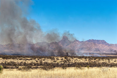
While eating breakfast I saw what looked like fog initially off in the distance; a closer look said it was part of the local prairie on fire!


It turned out to be a series of controlled burns conduced under the auspices of the US Fish and Wildlife service I believe.  I saw the fire crews along the side of Highway 286 when I later on rode Scarlett to Arivaca.

The errand in Arivaca was the retrieval of two packages from Amazon.  They'd been shipped via UPS but the postal clerk gave me no hassle when I picked them up.  I've run into a couple of postmasters/clerks you see, in other towns and other times, who had minor issues with me using General Delivery services for non-USPS packages.  

On the way back to the campsite, after filling up the spare gas can at the Arivaca General Store's gas station, I stopped Scarlett for this view of the controlled burns:


Quite a lot of smoke eh?  Glad the fire crews were around to manage the fires.

Thursday, February 10

I cruised on down to Sasabe again, this time on Yagi, my Yamaha TW200 Dual Sport.  The objective was to get to that steep looking hill I'd seen to the west of the Border Patrol/Customs Station and see if it was climbable by Yagi.

It "looked" doable as I neared it.  Here was a view of it on the last flat spot before the actual hill:


I made sure Yagi was in first gear and slowly headed up.  I could feel the rear tire wanting to kick loose when I rode over the larger stones on the road but nothing major.  I did slide up a bit on the seat to put more pressure on the front tire, but not sure that made any difference really.

Got to the top with no problems!  I had though it was just one hill and then one would descend onto the Tohono O'odham Reservation but no, there were two more steep hills that I could see:


I stopped, turned around and parked Yagi for pictures.  As I did, a K9 Unit Border Patrol truck cruised by me, the driver waved, and kept going.  You can see him at the top of the next westward hill, monitoring me apparently.

Here's what it looked like going back the way I'd come:


The Border Patrol truck to my west was joined by another Border Patrol truck to my east at the bottom of the hill.  Thinking that at least there'd be a fast response to any issue experienced by me on the way down, I started downhill.

First gear of course, and with some ever so slight one-fingered action on the front brake initially.  Once I got over my nervousness, I quit using even that little bit of braking action and just relied on Yagi's engine braking to get me down safely!

The eastward Border Patrol agent then came up to me as I stopped for pictures.  We had a nice conversation after he ascertained why I was there.  "We don't get too many motorcycles around here" he said.  :)

He also mentioned it was good that I turned around when I did, apparently the hill climb two hills over was difficult even for their trucks!

It was a broad range of topics, and he was courteous and professional throughout, a very good experience!  I asked him about the big gaps in the wall.  His theory, nothing official you see, was that those particular gaps I'd seen before had required the approval of the Army Corps of Engineers due to their being on top of creek beds.  Apparently, according to the agent, the COE didn't get around to it and then another administration came into office and funds went away.  Not surprising eh?

Anyways, after a rather lengthy chat, I shook his hand and we parted ways.  I rode a bit on the dirt trails near the Rancho de la Osa trying to find the back way to the ranch.  I failed to do so and kept running into some rather steep and very rocky paths; and since I'd pushed my luck today about as far as I wanted to, gave up on that and headed back north.


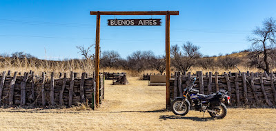
I stopped by the BANWR visitor center, then rode on over to Lake Aguirre only to find it dry since Winter is the dry season around here.  On the way, I spotted this Buenos Aires sign and assume it shows where the cattle stock yards were located back when the whole area was a private ranch.


I rode forest roads away from the Visitor Center, eventually finding my way to Arivaca Road.  A brief bit on the highway and then I detoured back onto another forest road: 232.  I explored this road, found another campsite candidate that I marked on Google Maps and then headed on back to camp.

Got back to camp just short of 3PM and would spend the rest of the afternoon just resting under the shade of my lounge chair umbrella, reading a book.  My coccyx is still a bit sore from the fall I had on the Baboquivari Peak Ranch trail the other day and all the riding probably didn't help.

Still, another good day under sunny and warm temperatures, can't complain!

Tuesday, February 08, 2022

Riding the Wall, near Sasabe, AZ

Once things warmed up above 50, closer to 60 degrees Fahrenheit this morning, I headed out on Scarlett, my 2014 Ural Patrol sidecar rig to check out the wall.

The wall I mean of course is the one put up by the US government along the Mexican Border to try and stem the flow of illegal immigrants from Mexico.  Trying to avoid politics as usual, but the only thing that kept coming up in my mind was something I learned while in the army:  An unobserved obstacle is no obstacle.   More on this concept in a moment.

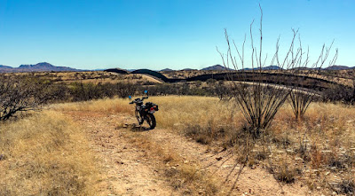
First, I headed west from the border station, riding along the wall, trying to get a bit closer to that big cut on the side of the hill spanned by the wall.  On the other side is the Tohono O'odham Nation Reservation.  I did some research (see links at end of this post) and there's NO fence on Reservation land!  

The Reservation's Native American police work in conjunction with the US Border Patrol apparently but yeah, no fence.  Apparently, the Tohono O'odham Nation had issues with the wall impeding movement of its people.  The reservation you see, sits astride the US/Mexico Border!

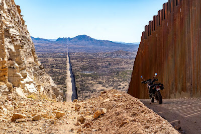
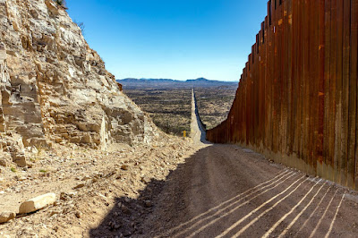
The top of the hill is the cut I mentioned, below
is a zoom closeup of it.


Looking east, you can see the Border Patrol station
and Customs Building.

A zoomed in view of the cut on the hillside to the
east of the border crossing.


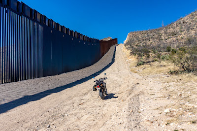
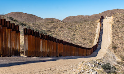
The wall creates this sort of surreal art work imagery
as it follows the terrain contours.

Just showing you how close the Baboquivari Peak
is located to the border.

I then rode east along the wall, to get closer to the other hillside cut.  


Along the way, I spied a stone monument and paused to examine it.


The plaque is rusted and impossible to read in full anymore.  Below is the best I could get after some post-processing.


Back to the army concept taught to me while in the army.  I saw at least two large gaps in the wall; apparently where dried up creek beds once ran?  Its apparently these gaps where Coyotes (men who take illegals near these points and point/lead them across).

I ran into a lady nearby, who introduced herself as Butterfly and said she was a volunteer with an outfit called Outlaws against Pedophiles.  She UDF'ed me for a bit, being also a motorcycle rider but spent most of the time talking about how Mexicans are using gaps in the wall such as these to sneak children into the country, for nefarious ends as human trafficking under the auspices of the drug cartels.

Yes, the US Border Patrol does and did drive by a couple of time while I was there but she remarked coverage isn't exactly 100%.  She was quite vocal about a group of 38 kids she spotted and tried to help just the other night.  As I understood it, her group tries to get help to these kids who otherwise will end up being abused by human traffickers and pedophiles in a vicious cycle.  If you wish to have more information from her, see link at end of this post.

I saw what looked like a small chapel, probably 
housing religious statuary perhaps?


Religious expressions in Spanish

In a rather more downcast and sober mood, I rode back into town thinking to fill up the spare gas cans at the Sasabe Store.  No luck, they're closed on Tuesdays!  Their gas pumps' credit card mechanisms weren't working so no gas for me today.

As I put stuff away, I saw this Sammy pull up from the nearby J. Barker Custom Knives lot.  I spoke briefly with the driver and he let me take photos while he went into the Post Office.


Between Mile Marker 7 and 8, is the main entrance to the BANWR, I posed Scarlett next to the sign as I headed back to the campsite near Mile Marker 16.


Got back after 2:30 PM I think, spent the rest of the afternoon reading under the shade of the umbrella I rigged onto my lounge chair.  This way, the heat of the sun flowed through but I wasn't exposed to its rays.

More Info on Sasabe, the border town itself.  Of note, it's owned (the town) by a Mexican National!


Link to a playlist of the videos by Butterfly, the lady I met on the border.  I told her I'd put a link in the video.  LINK.  Based on what I recall of her conversation with me, her views might be viewed as extreme by some.  YMMV, I am not verifying her content, just pointing out her info.