Saturday, Sep 12
Left Hunter Mesa at 8AM, got back on US Highway 16 heading west towards Worland, WY.
On the way there, passed through the hairpin portion of US16 which traverse Ten Sleep Canyon. Named as such by the native americans because it took ten sleeps or nights to get there from a origin that I can't recall at this moment....Buffalo area perhaps?


I got propane at Worland, almost 10 pounds, and then continued onwards on US20 towards the Boysen State Park. The park is located south of Wind River Canyon which itself is south of the town of Thermopolis, WY.
Quite the scenic drive, in fact, the road is named the Wind River Scenic Byway. Majestic Rock formations, a winding river with fishermen trying their luck and a twisty road that follow the river.
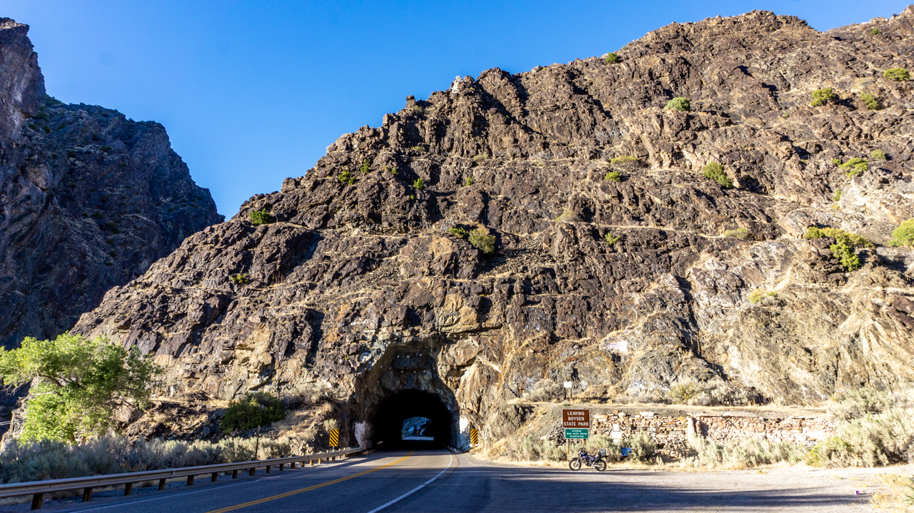
After traversing three short tunnels, I got to the Lower Wind River Campground where I had reservations for three nights. The sights are a bit cramped and I had a heck of time leveling the URRV but finally got it done. Before I set up though, I went down the road to the park HQ to dump tanks and take on water; then returning to the campground to setup for good.
After resting for a bit, went out to explore some sunset locations recommend by a park ranger that stopped and chatted with me about Fiona, he UDF'ed me, I quizzed him for good sunset spots. Fair deal.


After locating the spots, I cruised on back north on US Hwy 20 and checked out the rock formations while riding Yagi, my Yamaha TW200. She's more suited for canyon riding as the roadside shoulders aren't really that wide and the parking areas few and far between.
So, in waiting for the "Golden Hour" I instead ended up with half of Wind River Canyon's rock formations in the shadows due to the angle of the sun.


6 comments:
Really is a beautiful area!
The area looks like the snow never happened. Ah, and the clear blue chemtrail (haha) skies. Do you even know how lucky you are, being able to roam freely and see new places? I am so glad that you take the time and the effort to put out a post every so often. Thanks, Dom, I really appreciate it.
It truly is RichardM, truly
You’re quite welcome SonjaM, without this blog I’d have forgotten so many things and places by now.
Find any history on why named Wind River? You have not mentioned there is a reservation somewhere near there, or is it half the canyon?
Didn’t find but didn’t look either CCjon....the western half of the canyon is part of the Wind River Indian Reservation and off limits to public. Arapaho and Shoshone tribes live within.
Post a Comment