Monday, September 18, 2023

Day 3 at the San Luis Lakes SWA: Medano Pass

 Sunday, September 17

A good day of riding today.  I left camp shortly before 9AM and rode in brisk mid-40s temperatures the 20 miles or so to the trailhead within the Great Sand Dunes NP.

The sun was out, and kept things warm enough, especially once I started moving under 25 mph due to the conditions of the Medano Pass Trail.  It's signed as a Primitive Trail, and a sign warned that 4x4 was required.


When I saw this sign, I thought to myself: Uh Oh.


Still, I figured I'd continue and see how things go.  The first stream crossing was pretty long and though I tried keeping my boots dry by raising them as I rode on the stony creek bottom, it was no use.

The "stability" conditions were suboptimal, so I ended up using the legs as outriggers, and of course getting them wet as they went into the water.  Once my boots were full of water, it didn't matter as much so I just negotiated the next 3 water crossings with no issues.

I achieved no points for "style" mind you, but I didn't drop the motorcycle either.  Note: all stream crossing pics shot on the way back to the park from the pass.

Stream crossing number 5 almost proved my undoing.  I wasn't going fast enough and the engine stalled in the middle of the stream!


I got off Yagi, the after putting her in Neutral, pushed her to the far shore.  The water wasn't really deep in any of the crossings, knee high at worst.  Took a while to get her started again, but start she did! 

I realized I had to transfer the camera case to the tank bag, the hope being I could hold the motorcycle upright if she stalled again.

At some point, I crossed the western entrance to the Great Sand Dunes National Preserve.

The next few crossings weren't an issue, more soaking of the boots of course but no falls.  There were a few rock-strewn portions on the trail that were a bit technical but only one spot where I almost biffed it but managed to stay upright.


This is the one muddy portion that I, like others before me, bypassed by going to the left and over the grass bordering the obstacle:


Finally, I made it to the eastern entrance of the Great Sand Dunes National Preserve.  I made it to the pass!  Sadly, no majestic views, it was all forest.

A couple of signs marked the pass:


After a bit of rest I started heading back towards the National Park.  I took pictures on the way back, feeling more comfortable astride Yagi as I negotiated rocky sections, stream crossings and the frequent 4x4s on the trail.

Note: On the creek crossings that were longer, I would walk across first with the camera bag, then cross back to get Yagi and then ride her across.  No sense taking chances!


I made it back to the GSD NP soon enough, and I took pictures of the sand dunes as I slowly made my way back towards the main entrance.

At the Sand Pit Picnic Area where I took another break:


More views of the Great Sand Dunes as I motored towards the park entrance:


Some views of the dunes shot with the telephoto lens, can you spot the people?


Parting views of the dunes, as I left the national park:


In case you wondered why the dunes
formed here


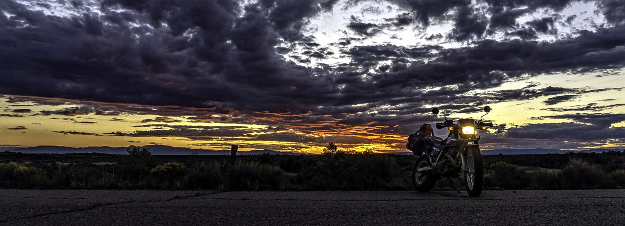
Yep, a good day of riding.  The sunset's parting light wasn't too bad either:


Saturday, September 16, 2023

Day 2 at the San Luis Lakes State Wildlife Area (SWA)

No Rain today!  Instead it was sunny and warm, the sun was so hot that it made 55 degrees feel much warmer!

I woke to temperatures in the low 40s but as I mentioned, once the sun was out in force, it was quite nice.  The Sangre de Cristo Mountain Range peaks were wreathed in low hanging clouds:


Later on, after breakfast, the skies cleared and would remain mostly clear for the rest of the day.  Here's the same peaks I took pictures of earlier in the morning, but now bathed in direct sunlight:


I rode out with Yagi, my TW200, to explore Mt Blanca Road.  I went into my reserve gasoline tankage on the way there....whoops.  Just as well, I didn't get very far up this road due to the rough riding conditions.  Note: there's dispersed camping along this road.

I really don't like riding on such rocks....

Blanca Peak


Pictures of my campsite under bright sunshine:


Not many clouds led to a pretty bland sunset today, but I shot some pics of the nearby peaks of the Sangre de Cristo Mountains during the golden hour:


Now Camping near the Great Sand Dunes NP

Friday, September 15

I'd seen yesterday that temperatures would be at least 10 degrees warmer than the dispersed camping area near Jefferson, CO.

It was an easy decision to leave earlier than planned to find myself a spot at the San Luis Lakes State Wildlife Area.  It used to be a State Park, now just a SWA but with one notable exception: there's electricity at each site!  So, now I'm camping, not boondocking as I luxuriate due to the availability of shore power.

It's a good deal even with the requirement you either have to have the appropriate number of SWA Day Passes or a Colorado Fishing License like I do.  That's the entire cost, the site is free as it is on all SWAs here in Colorado.  The fees collected from fishing/hunting licenses and day passes go to maintenance costs of the SWAs statewide.

I left early, drove under dark overcast skies all day and found a site easily enough.  It would rain the rest of the day, stopping after 5PM with overcast skies still overhead.  It's supposed to be only partly cloudy tomorrow and 68 degrees as a high!  


During a break in the rain, I motored about on Yagi, my TW200 re-acquainting myself with the area.  I'd been here before and had enjoyed it:  LINK

Going to be here for perhaps 10-12 days, you're allowed a max stay of 14 days.

Going to wait till the nearby Great Sand Dunes NP's sand mounds dry out a bit from the recent rains before visiting them.

Thursday, September 14, 2023

A Couple of Days Boondocking Near Jefferson, CO

Yesterday, the weather continued overcast and dreary.  Add to that a growing swarm of hunters, clad stylishly of course in camouflage patterns, led to me displacing to get away from the bastards.

As I left the area, I took a picture of why the nearby pass is called Rabbit Ears:

Shortly after noon, I had moved south to the Kenosha Pass/Jefferson, CO area.  Due to road closures, GoogleMaps had me route through Guanella Pass instead of CO Hwy 9.

Guanella Pass Summit

The weather in the dispersed camping area south of Jefferson, CO was much better in terms of very few campers and NO hunters as its a cattle grazing area.

There were several nice spots, but I passed them up as too large which might invite some encroaching camper to set up near me.

The weather on Wednesday was rainy and cold but today Thursday, it was slightly better and very slightly warmer.  I went riding on Yagi, my TW200, after lunch to re-acquaint myself with the forest trails in the area.


I did have one visitor to the campsite whom I didn't find objectionable:


Sadly, Fall Colors haven't started to appear as hoped for.  I've only spotted a few bits of color, spread quite apart from each other.  I'm thinking a couple more weeks perhaps before we have mass changing of the leaves' color.


Tomorrow, Friday, is supposed to be rainy and cooler.  So I'm going to displace further south in hopes of finding warmer/sunnier weather.