Saturday, April 08, 2023

More Pierce Ferry Boondocking

Thursday, April 6 (continued)

After lunch in Meadview, I rode Scarlett to South Cove, about six miles north of town to check it out


Its main feature is a large cement boat ramp, which due to water levels, was out of operation since it couldn't reach the water anymore


I wandered about the area and found a makeshift boat ramp in use. That's about it though and I returned to the camp site:

Back at camp, I managed to break the omnidirectional weBoost antenna and so have no cell signal at the VRRV anymore.

I either get crappy connectivity at the site of the old seismograph bunker or ride six miles to the junction Pierce Ferry Rd and Pearce Airstrip Rd where I get great signal. Oh well...

I relaxed the rest of the afternoon away.

Friday, April 7

After doing a check-in with Martha and the Z's while at the junction of Pierce Ferry Rd and Pearce Air Strip Rd, I headed down the rough "road" to the air strip to see what I could see. Turns out, you can see quite a lot! Popular spot too, there was a car park there and I would soon be joined by another car with some hikers and even a small plane landed on the strip while I was there. The pilot and his passenger apparently knew there was cellular internet connectivity here at the edge of the cliff near the air strip!
Gateway Rock Formations leading to South Cove

Airstrip with the plane that showed up


Colorado River at Pearce Ferry

A bit further out view

I can't imagine the upheaval forces that caused such
huge hunks to rise and up end like this.

Can you see Umarang?

Soon enough, I headed back the way I came, stopping only another pic of South Cove's entry rock formations
I stopped at the information plaques at the Pierce Ferry campground and got this info for you to flesh things out that I've mentioned before in previous posts


I then headed over to the location of Pierce Ferry, or at least, to the boat ramp used to take boats out of the Colorado River. I didn't find any remaining evidence of Ferry buildings and such, though I did ride a back trail that led to these small rapids:


I kept looking for this spot for a Then and Now moment but this is the best I got:

I returned to camp by 1:30 PM and rested the rest of the afternoon away as the overcast skies finally gave way to partly to mostly sunny skies and warming temperatures. Here's a few pics of Yagi as the golden hour neared....


Thursday, April 06, 2023

Pearce Ferry Boondocking

Wednesday, April 5

Left at 8am from the Griffith Rd BLM site and got Propane in Kingman at the Flying J truck stop. 8.1 Lbs.

Got to the next campsite, in the Pierce Ferry Campground area, by 11 I think. Marvelous rock formations all around and I've got the ridge top area to myself!

Cruised around the area on Yagi.

Spent the afternoon trouble shooting why the Yagi antenna isn't working. The omnidirectional antenna that came with the weBoost works but only when it's magnetic base is grounded.

The result is I can do slow texting, limited phone calls, and email... sometimes, along with very slow web browsing.

It was still windy and cold most of the day, in the evening during the golden hour I went out for a pootle with Yagi, my TW200.


Thursday, April 6

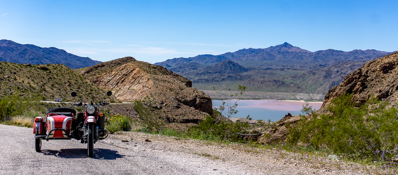
Went out before mid-morning to hopefully catch some good color before the sun flattened things out in terms of lighting:


After the above shot, I rode the couple miles or so to the Colorado River, near where Pearce's Ferry used to operate.  It's one of the several crossing points over the river, used by settlers.


The river a bit silty down here....


Returning to the Pearce Ferry campground run by the NPS, I checked out the stuff left behind by the Civilian Conservation Corps back in the mid 1930s...all in support of the Hoover Dam that would one day create Lake Mead.


There were two bunker structures up on the ridge where I'm boondocking.  They were built to support a project to monitor/study the earthquake activity that came about due to the dam.

The closest structure used to house the generator that supported the seismograph equipment:


Views through the bunker's window openings:


The second, more distant, bunker housed the seismograph equipment.  That's all gone of course, and apparently ass wipes have been using it as a garbage dump:


Going to drive Scarlett into Meadview for lunch.  Will pick up from there in the next post.

Tuesday, April 04, 2023

Last Day in the Ogilby Road BLM area, now enroute to Lake Mead Area

Monday, April 03

Before it got really windy today, I took Scarlett out for a ride towards the American Girl Mine area.


I got back to camp by 9AM and by 11AM the wind was gusting into the 20s and 30s in terms of mph.  The VRRV was rocking slightly with each wind gust as she was almost broadside to the winds.

Dust was stirred up of course and the rest of the day was spent inside, out of the wind and dust.  Got some cleaning done and it was surprising how much dust had gotten into the VRRV!

I packed up the motorcycles in the late afternoon, feeling sand blasted by the wind as I did so.

Tuesday, April 04

Left soon after 7AM and got my leftover Mexican Pesos changed back to US Dollars.  I had a bit over $140 left from the $500 cash I took into Baja California, not too bad I guess.

Then, in a senior moment, I left for the Quartzite area before remembering much later that I was supposed to pick up some Amazon packages from the locker!  Dammit.  Oh well, they'll be retrieved after 3 days and my account credited.  Then I will reorder I guess.

When I got to Quartzite, the place still seemed to have a lot of RVs in evidence.  I checked a couple of candidate sites and elected to keep moving north instead.

Staying on AZ 95, I saw that BLM sites near the highway were all crammed full of RVs and other campers!  This was especially so in the areas around Lake Havasu City!  Needless to say, I kept going.

I would end up at a site off of I-40 close to Drake, AZ.  There were two obvious campsites along the road past the gated entrance.   One other Class C was already there and I grabbed the second site that was 1.6 miles from the gate.


Some somewhat scenic mountains in the distance but otherwise, not much else to recommend this place for extended stays; for one night it'll be fine.

Sunday, April 02, 2023

Finally Locating the American Girl Mine after a second Fail due to Google Maps

Today, since google maps had told me I'd turned around yesterday a mere .6 miles from the American Girl Mine; I decided to give it another go.

This time though, after riding to the .6 mile point, I parked Yagi, my TW200 and walked the rest of the way to where Google was saying the mine was located.

This was the washout that had stopped me yesterday.  It doesn't look steep but I couldn't even walk down it without slipping too much.  I had to go off to the side a bit to get down.


The rest of the .6 miles that lay ahead of me, steep, rock-strewn and rutted:


I get to the destination, no mine!  In fact, once I wandered about a bit and get a cell signal, google maps was telling me I now had over five miles to go!  WTH.

This is what I saw from the top of the "pass" where the mine was supposed to be:


I walked down the above trail a bit, to get this shot of the valley below where google maps was now saying I had to go.


Obviously, google maps was confused.  So I walked back to Yagi and negotiated the sketchy washouts I'd gone through to get to the bad destination.

Once back in the campsite area, I decided to "wing it" and try and find the American Girl Mine using basic map navigation.  I kept an eye on where google maps said I was, and I headed in what I thought was the general direction of the mine's location as reported by Google.

Google Map continued to insist that I use the route I'd already tried and had discarded.  Eventually, I found the mine!  The water filled pit was a dead giveaway.

American Girl Mine is now a large open pit mine complex.  There must have been a bunch of gold here, to justify the efforts and equipment involved in creating this:


There was a rough trail leading down into the open mine pit, all the way to the water:


As I had walked about near the water, I'd spied four people walking on the top of the rim.  Curious, I located them once I had gotten out of the mine pit and took this picture:


I think, they were digging up dirt that they believed contained gold ore.  They took four 5 Gallon buckets of the stuff back to their car.  I guess they'll sift through it somewhere else where they've access to water.

One last look at the open pit mine that is
the American Girl Mine

The rest of the day was spent around camp.  Temperatures would climb to the low 80s and it felt great!  Even when there were wind gusts, they were warm wind gusts!  Best of all, the one remaining RV within line of sight of me, left!  No one now within easy sight of my camp.  Good stuff.